Latitude: 52.3647 / 52°21'52"N
Longitude: -2.7179 / 2°43'4"W
OS Eastings: 351215
OS Northings: 274316
OS Grid: SO512743
Mapcode National: GBR BK.S5LB
Mapcode Global: VH843.VT1L
Plus Code: 9C4V977J+VV
Entry Name: 55, Lower Broad Street
Listing Date: 15 March 1974
Grade: II
Source: Historic England
Source ID: 1290271
English Heritage Legacy ID: 389988
ID on this website: 101290271
Location: Ludford, Shropshire, SY8
County: Shropshire
Civil Parish: Ludlow
Built-Up Area: Ludlow
Traditional County: Shropshire
Lieutenancy Area (Ceremonial County): Shropshire
Church of England Parish: Ludlow St Laurence
Church of England Diocese: Hereford
Tagged with: Building
LUDLOW
SO5174 LOWER BROAD STREET 825-1/1/355 (West side) 15/03/74 No.55
GV II
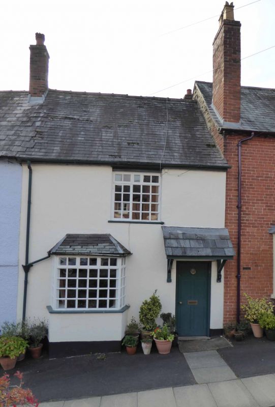
House. Late C17. Stucco; Welsh slate to front pitch, plain tiles to rear; brick stack to rear. 2-storeys; single-window range: C20 casement with glazing bars. Entrance to right: C20 half-glazed door and pentice hood; to left, canted bay with C20 glazing bars and lights. Wing to rear: roughcast; C20 fenestration; old tiles.
Listing NGR: SO5121574316
External links are from the relevant listing authority and, where applicable, Wikidata. Wikidata IDs may be related buildings as well as this specific building. If you want to add or update a link, you will need to do so by editing the Wikidata entry.


Other nearby listed buildings