Latitude: 53.2841 / 53°17'2"N
Longitude: -1.8026 / 1°48'9"W
OS Eastings: 413260
OS Northings: 376370
OS Grid: SK132763
Mapcode National: GBR HZVG.KF
Mapcode Global: WHCCS.8QW5
Plus Code: 9C5W75MW+MX
Entry Name: Wheston Hall, Gate Piers and Boundary Walls
Listing Date: 30 August 1984
Grade: II
Source: Historic England
Source ID: 1288177
English Heritage Legacy ID: 400379
ID on this website: 101288177
Location: Wheston, Derbyshire Dales, Derbyshire, SK17
County: Derbyshire
District: Derbyshire Dales
Civil Parish: Wheston
Traditional County: Derbyshire
Lieutenancy Area (Ceremonial County): Derbyshire
Church of England Parish: Tideswell St John the Baptist
Church of England Diocese: Derby
Tagged with: Farmhouse
SK 17 NW PARISH OF WHESTON 3/42 ?9.9.5i Wheston Hall, gate piers and boundary walls (formerly listed as Wheston Hall)
II
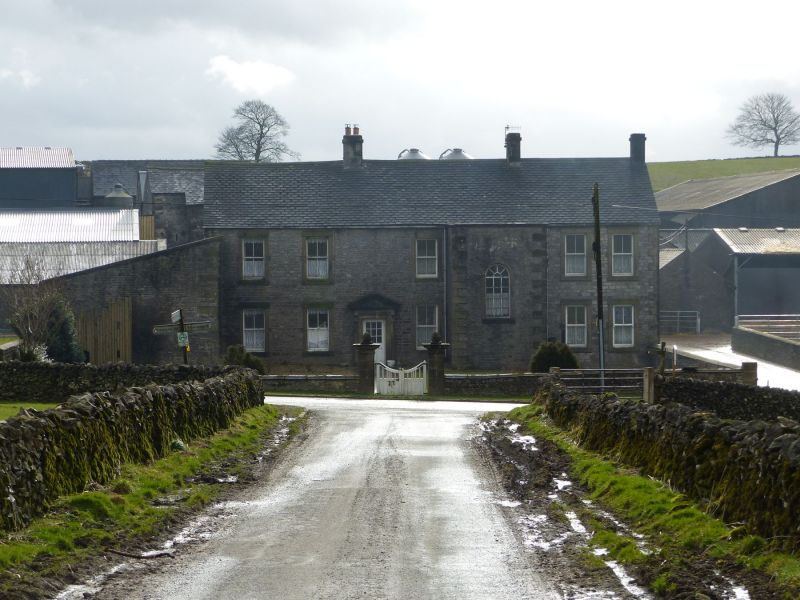
Farmhouse, formerly country house. Mid=C18, incorporating C17 fragments and having been totally remodelled in mid-C20. Coursed rubble limestone with gritstone dressings projecting quoins, plain gables, intermediate and gable ridge stacks of stone, and concrete tiles to roof. Two storeys, six bays, with off-centre advanced bay with moulded cornice to parapet. Sash windows without glazing bars, in flush stone surrounds, Advanced bay has semi-circular headed opening with keyblock and radiating glazing bars to head of window frame. Off-centre doorway with moulded architrave and pediment supported by moulded brackets. C20 half glazed door. Low garden wall with saddleback copings incorporating stone gate piers, square on plan, and with a moulded band and projecting moulded caps with cone finials. Monopitch roofed projection at east end, formerly a projecting two bay wing with C17 storeys. History: the house was formerly an eight bay country house of three storeys, with a parapet and full height advanced stair towers to each side of the then central doorway, The two bays at either end projected beyond the staircase bays.
Listing NGR: SK1326076370
External links are from the relevant listing authority and, where applicable, Wikidata. Wikidata IDs may be related buildings as well as this specific building. If you want to add or update a link, you will need to do so by editing the Wikidata entry.


Other nearby listed buildings