Latitude: 52.522 / 52°31'19"N
Longitude: -1.998 / 1°59'52"W
OS Eastings: 400234
OS Northings: 291568
OS Grid: SP002915
Mapcode National: GBR 29S.RT
Mapcode Global: VH9YN.BW30
Plus Code: 9C4WG2C2+QR
Entry Name: Highfields
Listing Date: 4 December 1985
Grade: II
Source: Historic England
Source ID: 1287601
English Heritage Legacy ID: 219312
ID on this website: 101287601
Location: West Bromwich, Sandwell, West Midlands, B70
County: Sandwell
Electoral Ward/Division: West Bromwich Central
Parish: Non Civil Parish
Built-Up Area: West Bromwich
Traditional County: Staffordshire
Lieutenancy Area (Ceremonial County): West Midlands
Church of England Parish: West Bromwich St Andrew
Church of England Diocese: Lichfield
Tagged with: Building
SANDWELL MB HIGH STREET (north-east side) SP 0091 NW West Bromwich 13/101 Highfields 4.12.85 II
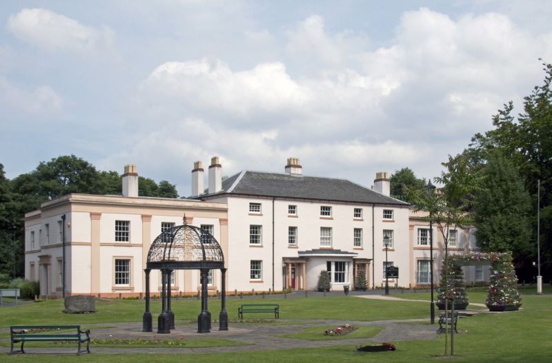
Four houses, now offices. Probably 1830s. Stuccoed brick with hipped slate roofs. Comprises a three-storey five-bay central block with lower two-storey three-bay wings to each side. The windows are mostly sashed with glazing bars. Windows in the second and fourth bays of the main block over the entrances are narrower than the rest. The third and fifth bays of the main block are bowed on the ground floor, now with overhanging C20 felt roofs. The left-hand one has a tripartite sash with pilasters as mullions. The right-hand bow has three windows, with a pediment above the central one. The second floor windows of the main block are casements. Doors, in the second and fourth bays, have Tuscan porches, each having a reeded frieze with paterae. The three lower bays to the left are separated by pilaster strips. The ground floor windows have architraves. The three right-hand bays are similar, but are separated by pilasters and have sashed windows on the ground floor. The left-hand bay of these three has wider windows. Chimneys in centre and on end walls of main block, between first and second bays at left, and between second and third bays at right.
Listing NGR: SP0023491568
External links are from the relevant listing authority and, where applicable, Wikidata. Wikidata IDs may be related buildings as well as this specific building. If you want to add or update a link, you will need to do so by editing the Wikidata entry.


Other nearby listed buildings