Latitude: 53.5961 / 53°35'45"N
Longitude: -1.0631 / 1°3'47"W
OS Eastings: 462106
OS Northings: 411462
OS Grid: SE621114
Mapcode National: GBR PV0V.NN
Mapcode Global: WHFDV.MWZ2
Plus Code: 9C5WHWWP+CQ
Entry Name: Bramwith Bridge
Listing Date: 29 September 1987
Grade: II
Source: Historic England
Source ID: 1286444
English Heritage Legacy ID: 334656
ID on this website: 101286444
Location: Kirk Bramwith, Doncaster, South Yorkshire, DN7
County: Doncaster
Civil Parish: Stainforth
Traditional County: Yorkshire
Lieutenancy Area (Ceremonial County): South Yorkshire
Church of England Parish: Kirk Bramwith St Mary with Fenwick and Moss
Church of England Diocese: Sheffield
Tagged with: Bridge
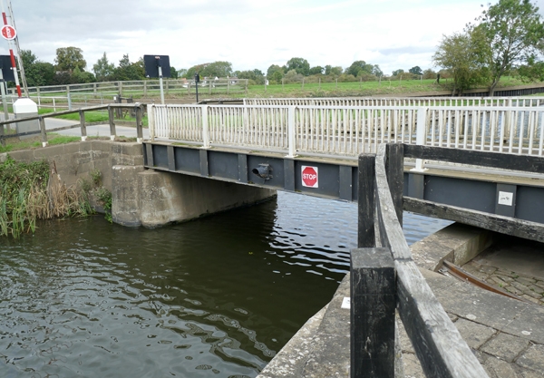
STAINFORTH LOW LANE SE 61 SW 6/79 Bramwith Bridge II Swing bridge. Early C19 altered C20. For the River Don Navigation. Dressed gritstone with C20 steel and wooden bridge platform. Stone abutment walls to each bank with manually-operated bridge pivotting within on arcuate recess on south bank. North abutment has concave side walls with 2 rounded piers on each side. South abutment wall is convex and set about the bridge are associated winch mechanisms, steps and a block against which the fully open bridge rests. Well-preserved example, most others having been replaced by lifting bridges or removed altogether.
Listing NGR: SE6210611462
External links are from the relevant listing authority and, where applicable, Wikidata. Wikidata IDs may be related buildings as well as this specific building. If you want to add or update a link, you will need to do so by editing the Wikidata entry.


Other nearby listed buildings