Latitude: 51.125 / 51°7'29"N
Longitude: -1.8161 / 1°48'57"W
OS Eastings: 412966
OS Northings: 136205
OS Grid: SU129362
Mapcode National: GBR 50M.HMT
Mapcode Global: VHB5J.GZRG
Plus Code: 9C3W45FM+XH
Entry Name: Heale Bridge
Listing Date: 10 October 1988
Grade: II
Source: Historic England
Source ID: 1284286
English Heritage Legacy ID: 321453
ID on this website: 101284286
Location: Netton, Wiltshire, SP4
County: Wiltshire
Civil Parish: Durnford
Traditional County: Wiltshire
Lieutenancy Area (Ceremonial County): Wiltshire
Church of England Parish: Woodford Valley with Archers Gate
Church of England Diocese: Salisbury
Tagged with: Bridge
DURNFORD SALTERTON SU 13 NW 8/142 Heale Bridge
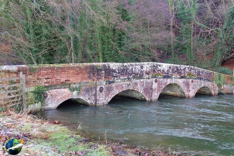
II Bridleway bridge over River Avon, between Salterton and Netton. C18. Brickwork. A single carriageway on five graded segmental arches of 27cm brick rings with expressed keys. Each bay divided by brick pilasters with stone chamfered coping and rounded cutwaters. Stone string course and 27cm brick parapet with flush half-round brick copings.
Listing NGR: SU1296636205
External links are from the relevant listing authority and, where applicable, Wikidata. Wikidata IDs may be related buildings as well as this specific building. If you want to add or update a link, you will need to do so by editing the Wikidata entry.


Other nearby listed buildings