Latitude: 51.8745 / 51°52'28"N
Longitude: -1.4846 / 1°29'4"W
OS Eastings: 435576
OS Northings: 219671
OS Grid: SP355196
Mapcode National: GBR 6TM.HGK
Mapcode Global: VHBZP.64ZV
Plus Code: 9C3WVGF8+Q4
Entry Name: Doggetts
Listing Date: 18 May 1990
Grade: II
Source: Historic England
Source ID: 1283776
English Heritage Legacy ID: 254249
ID on this website: 101283776
Location: Charlbury, West Oxfordshire, OX7
County: Oxfordshire
District: West Oxfordshire
Civil Parish: Charlbury
Built-Up Area: Charlbury
Traditional County: Oxfordshire
Lieutenancy Area (Ceremonial County): Oxfordshire
Church of England Parish: Charlbury with Shorthampton
Church of England Diocese: Oxford
Tagged with: Building
CHARLBURY THAMES STREET SP3519 5/106 (Vest side) Doggetts GV II
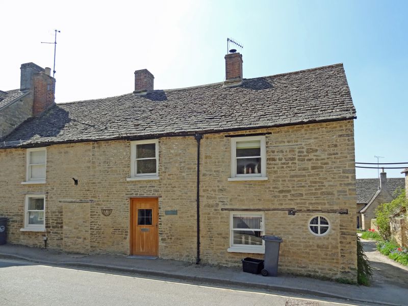
Farmhouse, subsequently 3 cottages, now one house. C18 with later alterations. Coursed squared rubble; timber lintels; stone-slate roof, partly replaced by concrete tiles to rear, with 2 brick ridge chimneys and end stock to left. 2 storeys with attic at right end. 3-window range of large-pane sashes with horns. Part-glazed door to left of centre and another blocked doorway with bullseye window at right end. Lintels of earlier windows survive on ground and first floors at right end, and texture of stonework suggests a former wide (workshop?) window at first floor in the centre bay. Interior has fireplace with wooden bressumer at right end, and changes in floor levels alone indicate that this part may be earlier than the rest of the building.
Listing NGR: SP3557719671
External links are from the relevant listing authority and, where applicable, Wikidata. Wikidata IDs may be related buildings as well as this specific building. If you want to add or update a link, you will need to do so by editing the Wikidata entry.


Other nearby listed buildings