Latitude: 54.5447 / 54°32'41"N
Longitude: -1.9242 / 1°55'27"W
OS Eastings: 405002
OS Northings: 516612
OS Grid: NZ050166
Mapcode National: GBR HH0W.6M
Mapcode Global: WHB4L.D1Y7
Plus Code: 9C6WG3VG+V8
Entry Name: 9, 11 and 11A, Galgate
Listing Date: 22 February 1973
Grade: II
Source: Historic England
Source ID: 1282878
English Heritage Legacy ID: 388645
ID on this website: 101282878
Location: Barnard Castle, County Durham, DL12
County: County Durham
Civil Parish: Barnard Castle
Built-Up Area: Barnard Castle
Traditional County: Durham
Lieutenancy Area (Ceremonial County): County Durham
Church of England Parish: Barnard Castle with Whorlton
Church of England Diocese: Durham
Tagged with: Building
BARNARD CASTLE
NZ0516NW GALGATE 770-1/4/16 (South East side) 22/02/73 Nos.9, 11 AND 11A
GV II
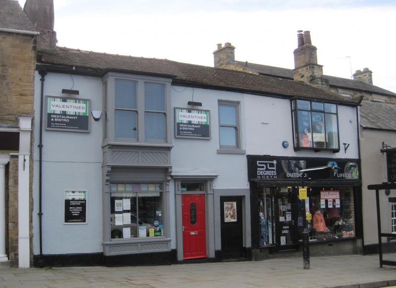
House, now shops and flats. Mid C18 with C19 and C20 alterations. Painted incised render with painted plinth and painted ashlar dressings; rubble right return; roof of plain tiles with incised render on chimney. 2 storeys; 3-window range. Central low boarded yard door in tooled stone surround. To left of this a mid C19 three-panel door and overlight in surround of simple pilasters and entablature. At left, a shallow square 2-storey bay window, the lower with recessed 2-pane shop window with glazing bars and tinted glass to upper part, and moulded brackets flanking fascia and supporting upper bay. Plain sash over yard door has painted projecting stone sill. C20 shop at right has plain fascia board which may cover C19 detail; plain 3-light shallow oriel window above. Roof has slightly swept eaves, and massive, battered left end chimney on plinth. Right end moulded kneeler. INTERIOR: not inspected.
Listing NGR: NZ0500416615
External links are from the relevant listing authority and, where applicable, Wikidata. Wikidata IDs may be related buildings as well as this specific building. If you want to add or update a link, you will need to do so by editing the Wikidata entry.


Other nearby listed buildings