Latitude: 52.5999 / 52°35'59"N
Longitude: -2.1605 / 2°9'37"W
OS Eastings: 389224
OS Northings: 300248
OS Grid: SJ892002
Mapcode National: GBR 15D.6D
Mapcode Global: WHBFR.SXC6
Plus Code: 9C4VHRXQ+XQ
Entry Name: The Barn
Listing Date: 3 February 1977
Last Amended: 31 March 1992
Grade: II
Source: Historic England
Source ID: 1282473
English Heritage Legacy ID: 378478
ID on this website: 101282473
Location: Stockwell End, Wolverhampton, West Midlands, WV6
County: City of Wolverhampton
Electoral Ward/Division: Tettenhall Regis
Parish: Non Civil Parish
Built-Up Area: Wolverhampton
Traditional County: Staffordshire
Lieutenancy Area (Ceremonial County): West Midlands
Church of England Parish: Tettenhall Regis
Church of England Diocese: Lichfield
Tagged with: Barn
WOLVERHAMPTON
SJ8900 LOWER STREET, Tettenhall 895-1/9/135 (West side) 03/02/77 The Barn (Formerly Listed as: CHURCH WALK, Tettenhall (South side) Barn to south of No 1)
GV II
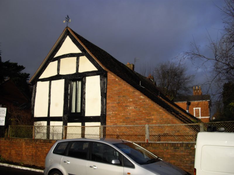
Barn with rear slaughterhouse, now house. Probably C17; converted late C20. Timber frame with 2 brick outshuts under catslide roofs and brick rear wing. 3-bay plan with central threshing floor. Entrance to threshing floor has C20 infill with paired plank doors; outshuts have inserted C20 windows and recessed dormers. Returns and rear have exposed timber framing with inserted C20 windows; wing has window and entrance with C20 casements and door. INTERIOR: internal timber-framed walls and roof trusses with raking struts. Although converted, the building retains strong group value.
Listing NGR: SJ8922400248
External links are from the relevant listing authority and, where applicable, Wikidata. Wikidata IDs may be related buildings as well as this specific building. If you want to add or update a link, you will need to do so by editing the Wikidata entry.


Other nearby listed buildings