Latitude: 52.3673 / 52°22'2"N
Longitude: -2.719 / 2°43'8"W
OS Eastings: 351140
OS Northings: 274600
OS Grid: SO511746
Mapcode National: GBR BK.RZ6B
Mapcode Global: VH843.TRFM
Plus Code: 9C4V978J+W9
Entry Name: 59, Broad Street
Listing Date: 15 April 1954
Grade: II
Source: Historic England
Source ID: 1282000
English Heritage Legacy ID: 389778
Also known as: Fat Face
ID on this website: 101282000
LUDLOW
SO5174 BROAD STREET 825-1/1/154 (West side) 15/04/54 No.59
GV II
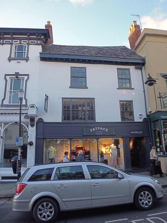
House, now shop. C18. Stucco; Welsh slate roof; brick end stack with C19 superstructure. 3-storeys; 2-window range: to right, 6/6 sash in broad moulded case; to left, 4-light window with upper casements; 8/8 and 6/6 sashes in broad moulded cases, over; moulded and modillioned wood eaves. C20 shopfront.
Listing NGR: SO5113974601
External links are from the relevant listing authority and, where applicable, Wikidata. Wikidata IDs may be related buildings as well as this specific building. If you want to add or update a link, you will need to do so by editing the Wikidata entry.


Other nearby listed buildings