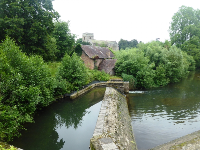
Latitude: 52.3862 / 52°23'10"N
Longitude: -2.7634 / 2°45'48"W
OS Eastings: 348140
OS Northings: 276732
OS Grid: SO481767
Mapcode National: GBR BJ.QSDZ
Mapcode Global: VH843.19Y3
Plus Code: 9C4V96PP+FJ
Entry Name: Sawmill
Listing Date: 9 August 1993
Grade: II
Source: Historic England
Source ID: 1281979
English Heritage Legacy ID: 389657
ID on this website: 101281979
Location: Bromfield, Shropshire, SY8
County: Shropshire
Civil Parish: Bromfield
Traditional County: Shropshire
Lieutenancy Area (Ceremonial County): Shropshire
Church of England Parish: Bromfield
Church of England Diocese: Hereford
Tagged with: Sawmill
BROMFIELD
SO47NE Sawmill 825-1/4/33
GV II
Sawmill. Mid C19 with C20 additions. Dressed stone; brick; plain tile roof; brick stack to rear. L-shaped plan. Single storey; 3-window range: tripartite wood mullion windows with cast-iron lattice glazing; stone sills and ashlar lintels; shouldered drip courses. Later porch hood on curved brackets over access to stone basement with various lights and openings. Double doors in gables, under segmental arches, with spike-finials over. Rear: wheelhouse of battened stud boarding; plain tile roof with ornamental barge-board and pendant-finial; to right, plain light; to left, tripartite light under shouldered drip course, both with cast-iron lattice lights; opening in dressed stone basement. INTERIOR: wheel removed on conversion to electricity, earlier C20, but retains racksaw and shafting. Included for group value. Forms a group with Cornmill (qv), Bridge over Teme (qv) and Weir (qv).
Listing NGR: SO4814876732
External links are from the relevant listing authority and, where applicable, Wikidata. Wikidata IDs may be related buildings as well as this specific building. If you want to add or update a link, you will need to do so by editing the Wikidata entry.


Other nearby listed buildings