Latitude: 51.0577 / 51°3'27"N
Longitude: 0.6929 / 0°41'34"E
OS Eastings: 588814
OS Northings: 132156
OS Grid: TQ888321
Mapcode National: GBR QW9.N06
Mapcode Global: FRA D6BB.3S1
Plus Code: 9F323M5V+35
Entry Name: Ratsbury
Listing Date: 8 May 1950
Grade: II
Source: Historic England
Source ID: 1281673
English Heritage Legacy ID: 179809
ID on this website: 101281673
Location: The Quarter, Ashford, Kent, TN30
County: Kent
District: Ashford
Civil Parish: Tenterden
Traditional County: Kent
Lieutenancy Area (Ceremonial County): Kent
Tagged with: Building
1. 1715 SMALLHYTHE ROAD (East Side)
Ratsbury TQ 83 SE 3/74 8.5.50.
II GV
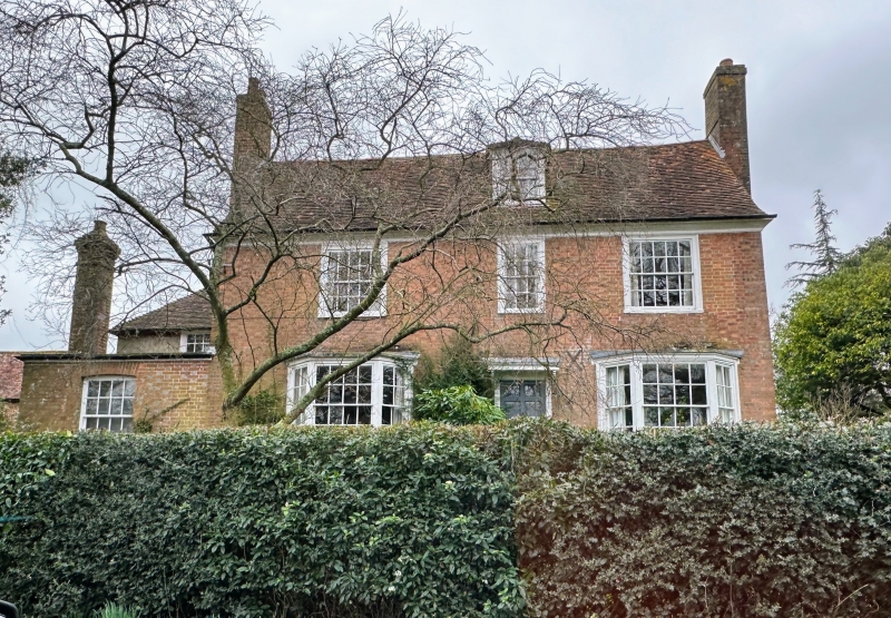
2. C18. 2 storeys and attic red brick. Tiled roof with moulded wooden eaves cornice and one dormer. 3 sashes with glazing bars intact. Venetian shutters on 1st floor. 2 bay windows on the ground floor. Doorcase with flat hood over and 6-panel moulded door, the top 2 panels cut away and glazed.
Ratsbury and Oasthouse, and Little Paddock form a group.
Listing NGR: TQ8881432156
External links are from the relevant listing authority and, where applicable, Wikidata. Wikidata IDs may be related buildings as well as this specific building. If you want to add or update a link, you will need to do so by editing the Wikidata entry.


Other nearby listed buildings