Latitude: 51.4475 / 51°26'51"N
Longitude: -2.589 / 2°35'20"W
OS Eastings: 359162
OS Northings: 172222
OS Grid: ST591722
Mapcode National: GBR C9M.DY
Mapcode Global: VH88N.2WN6
Plus Code: 9C3VCCX6+29
Entry Name: The Ship Inn
Listing Date: 20 February 1975
Grade: II
Source: Historic England
Source ID: 1280951
English Heritage Legacy ID: 379094
ID on this website: 101280951
Location: Box Makers Yard, Bristol, BS1
County: City of Bristol
Electoral Ward/Division: Central
Parish: Non Civil Parish
Built-Up Area: Bristol
Traditional County: Somerset
Lieutenancy Area (Ceremonial County): Bristol
Church of England Parish: St Mary Redcliffe with Temple, Bristol and St John the Baptist, Bedminster
Church of England Diocese: Bristol
Tagged with: Inn
This list entry was subject to a Minor Amendment on 26 August 2025 to add details to the Address and reformat the text to current standards
ST5972
901-1/42/1668
BRISTOL
CATHAY, Redcliff (South side)
The Ship Inn
20/02/75
GV
II
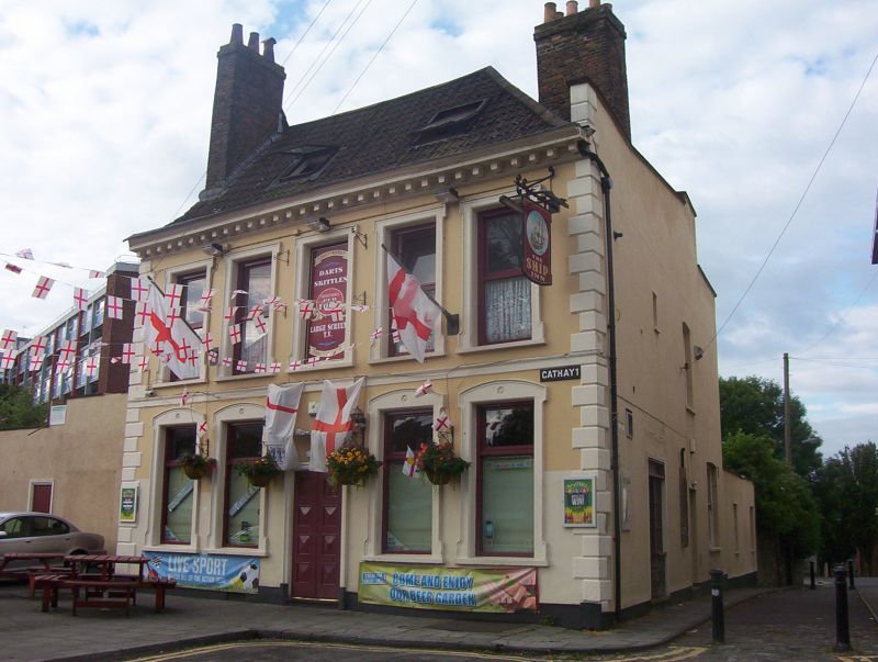
Public house. C18 with mid C19 refronting. Stucco over rubble walls, stone quoins, brick lateral stacks and triple Roman tiled roof hipped to the right. Double-depth plan, L-shaped to rear on right. Two storeys; five-window range. Symmetrical front has rusticated quoins, cornice with large dentils and parapet. Central doorway, flat-headed windows in segmental-arched architraves with ears and shoulders, the central one over the doorway blocked; stacks on gable and hip. C20 addition on left. Ship Lane elevation roughcast, with scattered fenestration.
INTERIOR: C20 public house interior.
(Gomme A: Street Index of Buildings of Architectural or Historic Interest: 11).
Listing NGR: ST5916272222
External links are from the relevant listing authority and, where applicable, Wikidata. Wikidata IDs may be related buildings as well as this specific building. If you want to add or update a link, you will need to do so by editing the Wikidata entry.


Other nearby listed buildings