Latitude: 50.2617 / 50°15'42"N
Longitude: -5.0524 / 5°3'8"W
OS Eastings: 182544
OS Northings: 44651
OS Grid: SW825446
Mapcode National: GBR ZF.XN1B
Mapcode Global: FRA 089B.PHN
Plus Code: 9C2P7W6X+M3
Entry Name: 68, Lemon Street
Listing Date: 29 December 1950
Grade: II
Source: Historic England
Source ID: 1280560
English Heritage Legacy ID: 377483
ID on this website: 101280560
Location: Truro, Cornwall, TR1
County: Cornwall
Civil Parish: Truro
Built-Up Area: Truro
Traditional County: Cornwall
Lieutenancy Area (Ceremonial County): Cornwall
Church of England Parish: St John and St Paul, Truro
Church of England Diocese: Truro
Tagged with: Building
TRURO
SW8244NE LEMON STREET 880-1/7/168 (West side) 29/12/50 No.68
GV II
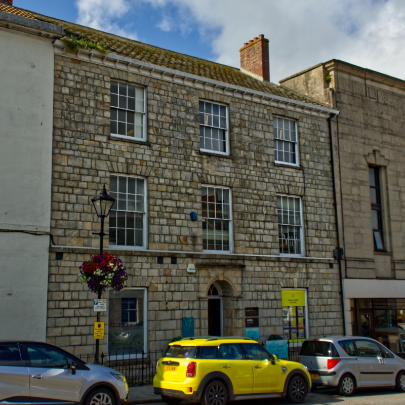
Town house, now shop. 1823. For Thomas Treloar, lessee, a merchant. Local freestone ashlar front over granite plinth, asbestos slate roof with brick end stacks. Double-depth plan with central entrance hall between 2 rooms at the front. 3 storeys; symmetrical 3-window front. Slightly projecting central round-arched doorway with ashlar pilasters, moulded architrave and moulded cornice; 6-panel door, traceried fanlight. First-floor sill string and wooden brackets under eaves soffit. Shallow segmental arches with projecting keyblocks over original 16-pane hornless sashes except to ground floor where replaced with plate glass. INTERIOR: open-well open-string stair with mahogany handrail scrolled over newel, doorcases with moulded architraves with corner blocks and moulded hoods, panelled window shutters and moulded and carved plaster ceilings. (The Truro Buildings Research Group: Lemon Street and its Neighbourhood: Truro: 1980-).
Listing NGR: SW8254444651
External links are from the relevant listing authority and, where applicable, Wikidata. Wikidata IDs may be related buildings as well as this specific building. If you want to add or update a link, you will need to do so by editing the Wikidata entry.


Other nearby listed buildings