Latitude: 50.4676 / 50°28'3"N
Longitude: -3.537 / 3°32'13"W
OS Eastings: 291013
OS Northings: 64216
OS Grid: SX910642
Mapcode National: GBR QV.WWCH
Mapcode Global: FRA 37GT.KTR
Plus Code: 9C2RFF97+25
Entry Name: Mulberry House
Listing Date: 3 May 1994
Grade: II
Source: Historic England
Source ID: 1280046
English Heritage Legacy ID: 390795
ID on this website: 101280046
Location: Torre, Torbay, Devon, TQ2
County: Torbay
Electoral Ward/Division: Tormohun
Parish: Non Civil Parish
Built-Up Area: Torquay
Traditional County: Devon
Lieutenancy Area (Ceremonial County): Devon
Church of England Parish: Torre All Saints
Church of England Diocese: Exeter
Tagged with: House
TORQUAY
SX9164 SCARBOROUGH ROAD 885-1/14/87 (South West side) No.1 Mulberry House
GV II
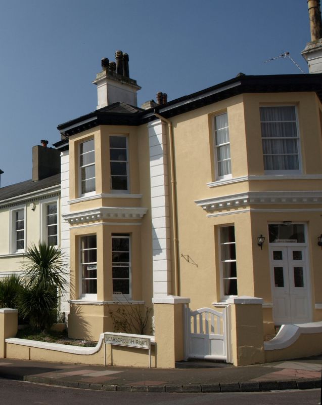
House. Late 1860s. Rendered; hipped slate roof; stacks with rendered shafts with platbands and cornices. PLAN: Deep rectangular plan, on a corner site. Entrance on north-west side into passage containing stair, principal rooms to front (south-west) facing onto Scarborough Road, services to rear. EXTERIOR: 2 storeys. Deep eaves on modillion brackets. 3-window entrance front, symmetrical to the right plus a canted bay on the corner at the left. Central front door, the doorcase with rounded corners, pilasters and a cornice on modillion brackets; 4-panel door with plain overlight. 3 first and 2 ground-floor windows with moulded architraves and sills, the ground-floor windows with keyholes, all glazed with probably original 2 over 2-pane sashes with horizontal glazing bars. Rusticated quoins to left of front, beyond that a 2-storey canted corner bay with triple windows, ground-floor centre window converted to 2-leaf door with overlight; moulded cornice with modillion brackets over. Similar bay to left (facing Scarborough Road) with rusticated quoins to left and right. INTERIOR: Original chimneypieces and joinery; stair with turned balusters. Important corner site between the listed terrace in Scarborough Road and coeval listed buildings in Croft Street.
Listing NGR: SX9101364216
External links are from the relevant listing authority and, where applicable, Wikidata. Wikidata IDs may be related buildings as well as this specific building. If you want to add or update a link, you will need to do so by editing the Wikidata entry.


Other nearby listed buildings