Latitude: 54.8982 / 54°53'53"N
Longitude: -1.4187 / 1°25'7"W
OS Eastings: 437376
OS Northings: 556100
OS Grid: NZ373561
Mapcode National: GBR V66.5P
Mapcode Global: WHD5C.54PS
Plus Code: 9C6WVHXJ+7G
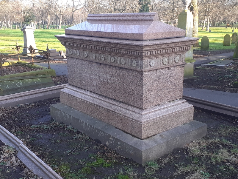
Entry Name: Bolam Tomb 200 Metres West of South East Lodge at Bishopwearmouth Cemetery
Listing Date: 17 October 1994
Grade: II
Source: Historic England
Source ID: 1279919
English Heritage Legacy ID: 391408
ID on this website: 101279919
Location: Bishopwearmouth Cemetery, High Barnes, Sunderland, Tyne and Wear, SR4
County: Sunderland
Electoral Ward/Division: Pallion
Parish: Non Civil Parish
Built-Up Area: Sunderland
Traditional County: Durham
Lieutenancy Area (Ceremonial County): Tyne and Wear
Church of England Parish: Bishopwearmouth St Gabriel
Church of England Diocese: Durham
Tagged with: Tomb
SUNDERLAND
NZ35NE CHESTER ROAD 920-1/4/37 (North side (off)) Bolam tomb 200 metres west of South-East Lodge at Bishopwearmouth Cemetery
GV II
Chest tomb with kerbstone. To John Bolam, 1815-1885, and members of his family. Polished red granite. Kerb with trefoil roll moulding and trefoil-gabled angle dwarf piers surrounds chest raised on platform. Chamfered plinth to chest with triglyph frieze with patera, and dentilled cornice; trefoil ridge roll moulding on hipped coping. Inscriptions on sides.
Listing NGR: NZ3737656100
External links are from the relevant listing authority and, where applicable, Wikidata. Wikidata IDs may be related buildings as well as this specific building. If you want to add or update a link, you will need to do so by editing the Wikidata entry.


Other nearby listed buildings