Latitude: 54.8903 / 54°53'24"N
Longitude: -1.4058 / 1°24'21"W
OS Eastings: 438209
OS Northings: 555220
OS Grid: NZ382552
Mapcode National: GBR V83.VZ
Mapcode Global: WHD5C.CBSW
Plus Code: 9C6WVHRV+4M
Entry Name: Humbledon Pumping Station
Listing Date: 10 November 1978
Grade: II
Source: Historic England
Source ID: 1279871
English Heritage Legacy ID: 391586
ID on this website: 101279871
Location: Humbledon, Sunderland, Tyne and Wear, SR3
County: Sunderland
Electoral Ward/Division: Barnes
Parish: Non Civil Parish
Built-Up Area: Sunderland
Traditional County: Durham
Lieutenancy Area (Ceremonial County): Tyne and Wear
Church of England Parish: Bishopwearmouth St Nicholas
Church of England Diocese: Durham
Tagged with: Architectural structure
SUNDERLAND
NZ3855 SEAFORTH ROAD 920-1/15/201 (South West side) 10/11/78 Humbledon Pumping Station
GV II
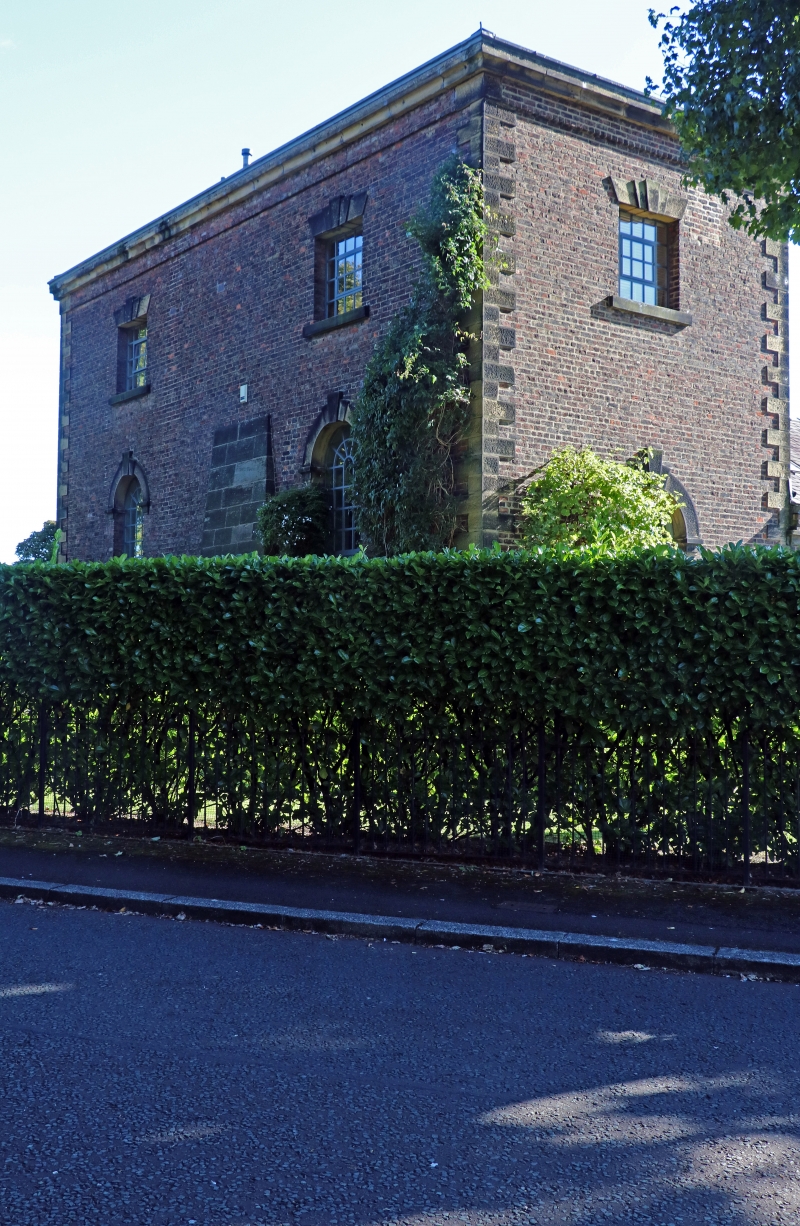
Water pumping station. 1846 and later. By Thomas Hawksley; from 1852 for the Sunderland and South Shields Water Company. English garden wall bond brick (3 and one) with ashlar plinth, quoins and dressings; Welsh slate roof. 2 high storeys, 2x1 windows to engine house; double range boiler house one high storey, 3 windows. Italianate style. NE elevation has engine house at right: ashlar-coped dwarf walls flank steps up to boarded door and overlight in plain jambs with triple-keyed plain stone surround to semicircular head on impost blocks; wedge stone lintel and projecting stone sill to blocked square window above. Boiler house on ground falling to left has stone voussoirs and triple key to high arch at right, next to engine house, and 3 blocked windows at high level with wedge stone lintels and projecting stone sills. Right return of engine house has 2 round-headed windows with surrounds similar to that of door, and to square windows above similar to those on NE; diagonal buttress between ground floor windows is of large ashlar blocks. SW elevation a mirror image of NE but with shorter steps, and with rectangular hole at top right of engine house. This was the first of a series of pumping stations designed by Hawksley, and continued by his son, to pump water through the magnesian limestone to provide the first good water supply for Sunderland. All windows blocked, boiler house chimney removed and pumping station out of use at time of survey. (Milburn GE and Miller ST: Sunderland River, Town and People: Sunderland: 1988-: 74; Corfe T: The Buildings of Sunderland 1814-1914: Newcastle: 1983-: 19).
Listing NGR: NZ3820955220
External links are from the relevant listing authority and, where applicable, Wikidata. Wikidata IDs may be related buildings as well as this specific building. If you want to add or update a link, you will need to do so by editing the Wikidata entry.


Other nearby listed buildings