Latitude: 51.1567 / 51°9'24"N
Longitude: -0.2188 / 0°13'7"W
OS Eastings: 524662
OS Northings: 141225
OS Grid: TQ246412
Mapcode National: GBR JJY.KHH
Mapcode Global: VHGSP.5663
Plus Code: 9C3X5Q4J+MF
Entry Name: Providence Chapel
Listing Date: 7 April 1983
Grade: II*
Source: Historic England
Source ID: 1277978
English Heritage Legacy ID: 429874
ID on this website: 101277978
Location: Providence Chapel, Charlwood, Mole Valley, Surrey, RH6
County: Surrey
District: Mole Valley
Civil Parish: Charlwood
Built-Up Area: Charlwood
Traditional County: Surrey
Lieutenancy Area (Ceremonial County): Surrey
Church of England Parish: Charlwood
Church of England Diocese: Southwark
Tagged with: Church building
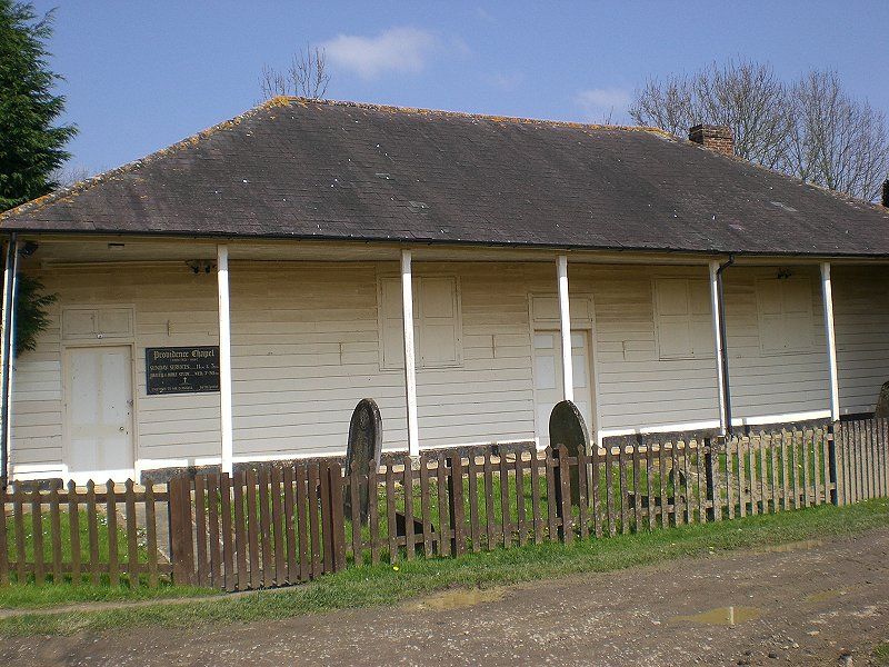
CHAPEL ROAD 1. 5387 (north-west side) Providence Chapel TQ 2441 5/6 II* 2. Erected in 1816 as "Charlwood Union Chapel" but was brought from Horsham and appears to date from circa 1800. One storey weather boarded on brick base. Hipped slate roof with brick chimney, the roof forming a verandah to the south-east elevation supported on 8 wooden columns. Three shuttered windows. Left side 4 panelled door and central 6 panelled door. Central path of Charlwood stone. The interior contains 2 vestries. The minister's vestry has an early C19 fireplace with reeded shelf. The octagonal pulpit at the north-east with pointed arched backboard and the table pew with square splay-sided table and flanking box pews date from the early C19. A most unusual building, more typical of New England than Surrey.
Listing NGR: TQ2466241225
External links are from the relevant listing authority and, where applicable, Wikidata. Wikidata IDs may be related buildings as well as this specific building. If you want to add or update a link, you will need to do so by editing the Wikidata entry.


Other nearby listed buildings