Latitude: 50.9529 / 50°57'10"N
Longitude: -0.8919 / 0°53'30"W
OS Eastings: 477933
OS Northings: 117632
OS Grid: SU779176
Mapcode National: GBR CCY.3BX
Mapcode Global: FRA 960L.JC2
Plus Code: 9C2XX435+47
Entry Name: The Stable block at Uppark to the north west of the house
Listing Date: 18 June 1959
Grade: I
Source: Historic England
Source ID: 1276851
English Heritage Legacy ID: 301805
ID on this website: 101276851
Location: Chichester, West Sussex, GU31
County: West Sussex
District: Chichester
Civil Parish: Harting
Traditional County: Sussex
Lieutenancy Area (Ceremonial County): West Sussex
Church of England Parish: Harting St Mary and St Gabriel
Church of England Diocese: Chichester
Tagged with: Stable
This list entry was subject to a Minor Amendment on 11 June 2025 to correct a typo in the name, address and description and to reformat the text to current standards
SU 71 NE
15/1C
HARTING
COMPTON ROAD
The Stable block at Uppark to the north west of the house
18.6.59
I
The south wing of the Stables is the second of the balancing blocks built by Sir Matthew Fetherstonhaugh about 1770, but behind it are two wings at right angles which form three sides of a courtyard. The south block is of red brick. Three centre window-bays project with pediment over. Hipped slate roof with turret cupola in the centre. Two storeys. Five windows.
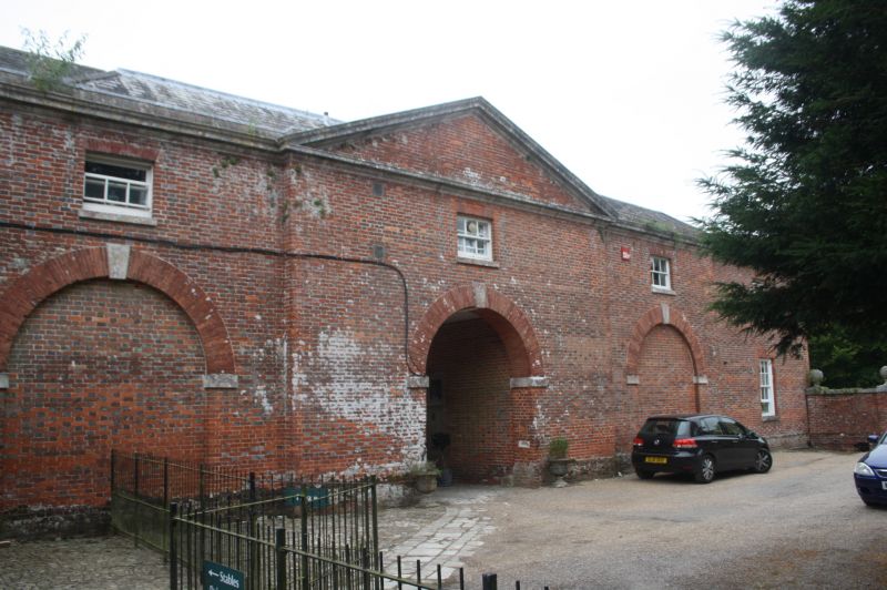
The wings behind (now Nos 1-4 National Trust flats and the Trust's Office) are of red brick and grey headers. Centre of east wing projects with a pediment over. Round-headed archway and similar blind arches flanking it. Five windows.
Listing NGR: SU7793317632
External links are from the relevant listing authority and, where applicable, Wikidata. Wikidata IDs may be related buildings as well as this specific building. If you want to add or update a link, you will need to do so by editing the Wikidata entry.


Other nearby listed buildings