Latitude: 51.808 / 51°48'28"N
Longitude: -0.0386 / 0°2'19"W
OS Eastings: 535318
OS Northings: 213975
OS Grid: TL353139
Mapcode National: GBR KBL.P16
Mapcode Global: VHGPH.8TYB
Plus Code: 9C3XRX56+6G
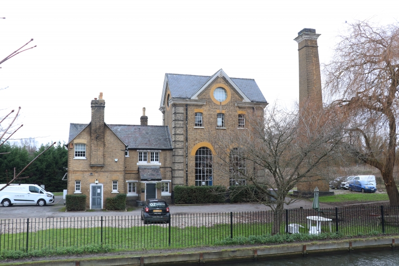
Entry Name: Broadmeads Pumping Station and Chimney
Listing Date: 4 January 1974
Last Amended: 13 September 1995
Grade: II
Source: Historic England
Source ID: 1275446
English Heritage Legacy ID: 412225
ID on this website: 101275446
Location: Ware, East Hertfordshire, SG12
County: Hertfordshire
District: East Hertfordshire
Civil Parish: Ware
Traditional County: Hertfordshire
Lieutenancy Area (Ceremonial County): Hertfordshire
Church of England Parish: Ware Christ Church
Church of England Diocese: St.Albans
Tagged with: Architectural structure
WARE TOWN
TL3513NW NEW RIVER 829-1/12/198 (North side) 04/01/74 Broadmeads Pumping Station and Chimney (Formerly Listed as: HERTFORD ROAD Broadmeads Pumping Station and Chimney)
II
Pumping station with adjoining house. Built 1881 by the New River Company. The main portion is a tall building of 2 storeys and attic. Yellow-brown stock brick, with vivid yellow dressings, rusticated quoins, Welsh slated roofs. 3 sash windows on first floor; 2 large round-headed windows on ground floor. Dentil eaves cornice, pedimented gables with circular windows, and gabled ends left and right. Adjoining to left small wing of lower elevation and L-shaped plan. 2 storeys, Welsh slated roof, yellow brick, 3 windows. Tall detached brick chimney to the right, battered profile, above square base with dentil cornice, with dentil cornice below set back top. At rear is single storey wing, yellow-brown brick with vivid yellow dressings, and Welsh slated roof. Arched semicircular windows, with glazing bars and stone cills, 2 in main elevation and one in east gable end. (The Industrial Archaeology of the British Isles: Branch Johnson W: The Industrial Archaeology of Hertfordshire: Newton Abbot: 1970-: 100, 179).
Listing NGR: TL3531813975
External links are from the relevant listing authority and, where applicable, Wikidata. Wikidata IDs may be related buildings as well as this specific building. If you want to add or update a link, you will need to do so by editing the Wikidata entry.


Other nearby listed buildings