Latitude: 50.7139 / 50°42'50"N
Longitude: -1.9885 / 1°59'18"W
OS Eastings: 400910
OS Northings: 90473
OS Grid: SZ009904
Mapcode National: GBR XQ4.CP
Mapcode Global: FRA 67Q6.358
Plus Code: 9C2WP276+HJ
Entry Name: The Hovel
Listing Date: 14 June 1954
Grade: II
Source: Historic England
Source ID: 1275383
English Heritage Legacy ID: 412532
ID on this website: 101275383
Location: Old Town, Bournemouth, Christchurch and Poole, Dorset, BH15
County: Bournemouth, Christchurch and Poole
Parish: Non Civil Parish
Built-Up Area: Poole
Traditional County: Dorset
Lieutenancy Area (Ceremonial County): Dorset
Church of England Parish: Poole St James with St Paul
Church of England Diocese: Salisbury
Tagged with: Architectural structure
POOLE
SZ0090SE MARKET STREET 958-1/17/85 (North West side) 14/06/54 No.4 The Hovel
GV II
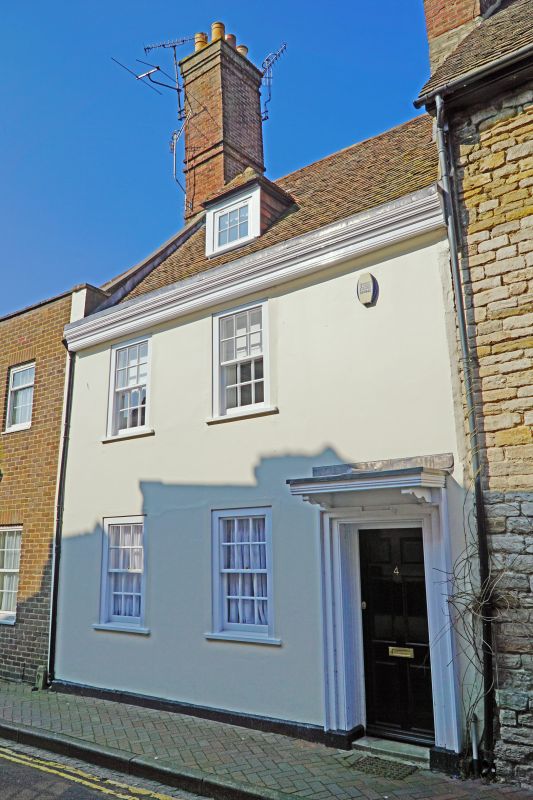
House. Early-mid C18. Stucco with an ashlar plinth, tall left-hand brick gable stack and a hipped tiled roof. 2-room right-angle plan. 2 storeys and attic; 2-window range. Right-hand doorway has eared, moulded architrave with flat canopy and late C20 door, 6/6-pane sashes in flush moulded frames; boxed eaves and hipped dormer with 3/3-pane sash. INTERIOR: reported to have a front room fireplace with Delft tiles, moulded architrave and a moulded dentil cornice, winder stair to the rear of the stack. HISTORICAL NOTE: an infill between Nos 2 & 6 (qv), and built around the large stack of No.6 (qv) to which it was formerly connected internally. (RCHME: County of Dorset (South East): London: 1970-: 229).
Listing NGR: SZ0091090473
External links are from the relevant listing authority and, where applicable, Wikidata. Wikidata IDs may be related buildings as well as this specific building. If you want to add or update a link, you will need to do so by editing the Wikidata entry.


Other nearby listed buildings