Latitude: 50.7124 / 50°42'44"N
Longitude: -1.9895 / 1°59'22"W
OS Eastings: 400840
OS Northings: 90308
OS Grid: SZ008903
Mapcode National: GBR XPZ.JD
Mapcode Global: FRA 67Q6.8RH
Plus Code: 9C2WP266+X6
Entry Name: Kinges Halle
Listing Date: 14 June 1954
Grade: II*
Source: Historic England
Source ID: 1275357
English Heritage Legacy ID: 412606
ID on this website: 101275357
Location: Old Town, Bournemouth, Christchurch and Poole, Dorset, BH15
County: Bournemouth, Christchurch and Poole
Parish: Non Civil Parish
Built-Up Area: Poole
Traditional County: Dorset
Lieutenancy Area (Ceremonial County): Dorset
Church of England Parish: Poole St James with St Paul
Church of England Diocese: Salisbury
Tagged with: Architectural structure
POOLE
SZ0090SE THAMES STREET 958-1/17/169 (South West side) 14/06/54 No.1 Kinges Halle
GV II*
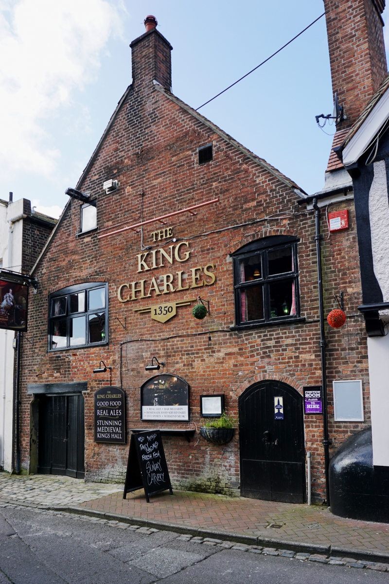
Formerly known as: Wool House THAMES STREET. Also known as: The King Charles Public House (part) THAMES STREET. Warehouse, incorporated into house, now public house. C15, divided and altered late C18. C15 limestone rubble with C18 brickwork, gable stack and a tiled roof. Rectangular plan. 2 storeys and attic; 2-window range to gable. E gable has a left-hand double doorway with lintel and C20 doors, and cambered heads to a right-hand doorway with C20 boarded doors, first-floor right-hand cross window, and left-hand mid C20 3-light mullion and transom window to the left. A small plate-glass left-hand attic light beneath a projecting lifting beam, and gable stack. Gabled W wall includes a blocked 2-light transom window with cinquefoil heads in a frame rebated for shutters; 2 blocked openings to S wall. INTERIOR: in W wall, set in round-arched embrasure, moulded stone mullion and transom cross window with cusped heads to upper lights. 3 roof trusses have braced, collared principal rafters on tie beams with V struts on collars; large-scantling rafters, set flat and with short supporting posts rising from chamfered wall plate; chamfered butt purlins; square-section ridge pieces. HISTORICAL NOTE: formerly the W end of the Town Cellar (qv), a substantial warehouse indicative of the town's prosperity in the C15. Separated when Thames Street was cut through to the Quay. (RCHME: County of Dorset (South East): London: 1970-: 204; Buildings of England: Pevsner N & Newman J: Dorset: London: 1972-: 323; Hillier J: A Portfolio of Old Poole: Poole: 1983-: 19).
Listing NGR: SZ0084090308
External links are from the relevant listing authority and, where applicable, Wikidata. Wikidata IDs may be related buildings as well as this specific building. If you want to add or update a link, you will need to do so by editing the Wikidata entry.


Other nearby listed buildings