Latitude: 53.6458 / 53°38'44"N
Longitude: -1.8371 / 1°50'13"W
OS Eastings: 410864
OS Northings: 416598
OS Grid: SE108165
Mapcode National: GBR HVM8.2T
Mapcode Global: WHCB0.RMCF
Plus Code: 9C5WJ5W7+85
Entry Name: 115, Side Lane
Listing Date: 29 September 1978
Grade: II
Source: Historic England
Source ID: 1275034
English Heritage Legacy ID: 413514
ID on this website: 101275034
Location: Longwood, Kirklees, West Yorkshire, HD3
County: Kirklees
Electoral Ward/Division: Golcar
Parish: Non Civil Parish
Built-Up Area: Huddersfield
Traditional County: Yorkshire
Lieutenancy Area (Ceremonial County): West Yorkshire
Church of England Parish: Longwood St Mark the Evangelist
Church of England Diocese: Leeds
Tagged with: Building
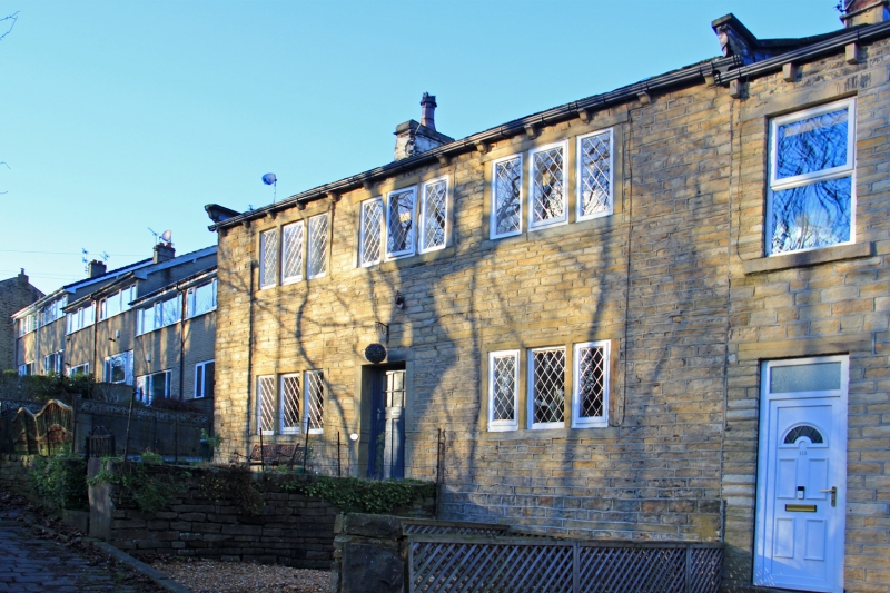
SIDE LANE 1. 5113 (North Side) Longwood No 115 SE 1016 32/1205 II 2. C18 or early C19. Hammer dressed stone. Pitched stone slate roof. Coped gables on cut kneelers. 2 storeys. Three 3-light stone mullioned windows on 1st floor, 2 on ground floor.
Listing NGR: SE1086416598
External links are from the relevant listing authority and, where applicable, Wikidata. Wikidata IDs may be related buildings as well as this specific building. If you want to add or update a link, you will need to do so by editing the Wikidata entry.


Other nearby listed buildings