Latitude: 50.8654 / 50°51'55"N
Longitude: -0.6311 / 0°37'52"W
OS Eastings: 496428
OS Northings: 108219
OS Grid: SU964082
Mapcode National: GBR FHX.P84
Mapcode Global: FRA 96KT.9XX
Plus Code: 9C2XV989+5H
Entry Name: The Well House
Listing Date: 5 June 1958
Grade: II
Source: Historic England
Source ID: 1274986
English Heritage Legacy ID: 413586
ID on this website: 101274986
Location: Slindon, Arun, West Sussex, BN18
County: West Sussex
District: Arun
Civil Parish: Slindon
Built-Up Area: Slindon
Traditional County: Sussex
Lieutenancy Area (Ceremonial County): West Sussex
Church of England Parish: Slindon St Mary
Church of England Diocese: Chichester
Tagged with: House
SU 9608 SLINDON SCHOOL HILL 22/295 (west side) 5.6.58 The Well House
II
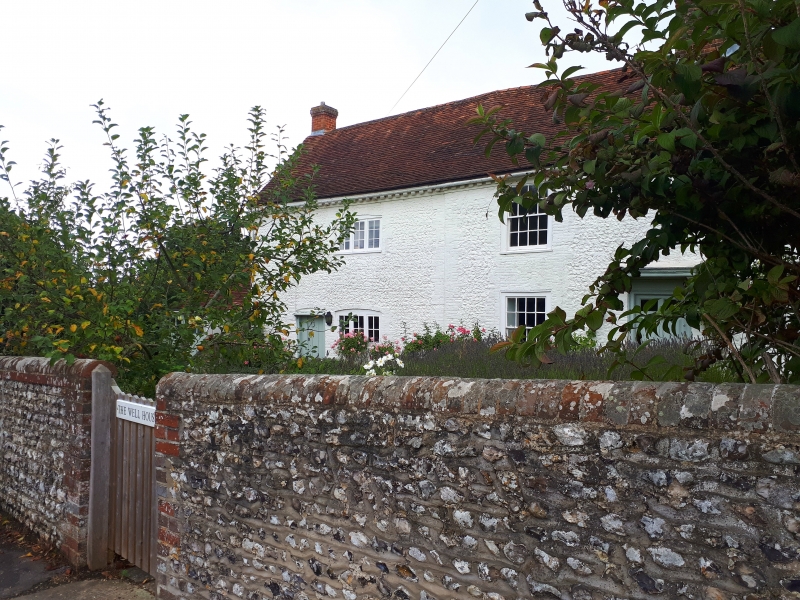
Dated 1694. Two storeys. Four windows. Faced with flints with brick dressings, quoins and modillion eaves cornice, all now painted. Tiled roof. Glazing bars intact. Doorway with flat hood on brackets and door of six fielded panels. Stone over with the date 1694 and the initials M. T. H.
Listing NGR: SU9642808219
External links are from the relevant listing authority and, where applicable, Wikidata. Wikidata IDs may be related buildings as well as this specific building. If you want to add or update a link, you will need to do so by editing the Wikidata entry.


Other nearby listed buildings