Latitude: 51.5133 / 51°30'47"N
Longitude: -0.1237 / 0°7'25"W
OS Eastings: 530294
OS Northings: 181044
OS Grid: TQ302810
Mapcode National: GBR JC.CP
Mapcode Global: VHGQZ.S7Y7
Plus Code: 9C3XGV7G+8G
Entry Name: 48-52, Long Acre WC2
Listing Date: 15 January 1973
Grade: II
Source: Historic England
Source ID: 1274716
English Heritage Legacy ID: 414457
ID on this website: 101274716
Location: Strand, Westminster, London, WC2E
County: London
District: City of Westminster
Electoral Ward/Division: St James's
Parish: Non Civil Parish
Built-Up Area: City of Westminster
Traditional County: Middlesex
Lieutenancy Area (Ceremonial County): Greater London
Church of England Parish: St Paul Covent Garden
Church of England Diocese: London
Tagged with: Building
TQ 3081 SW CITY OF WESTMINSTER LONG ACRE, WC2 59/20 15.1.73 Nos 48 to 52 (consec)
II G.V.
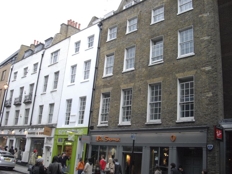
Terrace houses with shops. Early C19. Stock brick, Nos 50 to 52 painted, slate roofs. 4 storeys. Each front 2 windows wide, except for No 52 which has 3 windows. Ground floors have mid to later C19 warehouse fronts altered as shop fronts later C20: Nos 48 and 49 with double front with wooden pilasters carrying entablature; No 50 with square headed house doorway to left, with panelled door and fanlight, later C19 frame to shop front with consoles flanking fascia; Nos 51 and 52 with late C20 frontage of segmental arched openings and dwarf Ionic columns carrying fascia and bracketed cornice. Upper floors have recessed windows, majority retaining glazing bar sashes, a few with casements, under flat gauged arches. Parapet with coping. No 52 has cast iron balconettes to 2nd floor. Original lead rainwater heads and downpipes. Included for group interest only.
Listing NGR: TQ3031481042
External links are from the relevant listing authority and, where applicable, Wikidata. Wikidata IDs may be related buildings as well as this specific building. If you want to add or update a link, you will need to do so by editing the Wikidata entry.


Other nearby listed buildings