Latitude: 51.306 / 51°18'21"N
Longitude: 0.2308 / 0°13'50"E
OS Eastings: 555593
OS Northings: 158682
OS Grid: TQ555586
Mapcode National: GBR VS.GW5
Mapcode Global: VHHPL.YFCP
Plus Code: 9F32864J+98
Entry Name: The St Edith's Hall
Listing Date: 16 January 1975
Grade: II
Source: Historic England
Source ID: 1273471
English Heritage Legacy ID: 444851
ID on this website: 101273471
Location: Kemsing, Sevenoaks, Kent, TN15
County: Kent
District: Sevenoaks
Civil Parish: Kemsing
Built-Up Area: Otford
Traditional County: Kent
Lieutenancy Area (Ceremonial County): Kent
Church of England Parish: Kemsing St Mary the Virgin
Church of England Diocese: Rochester
Tagged with: Architectural structure
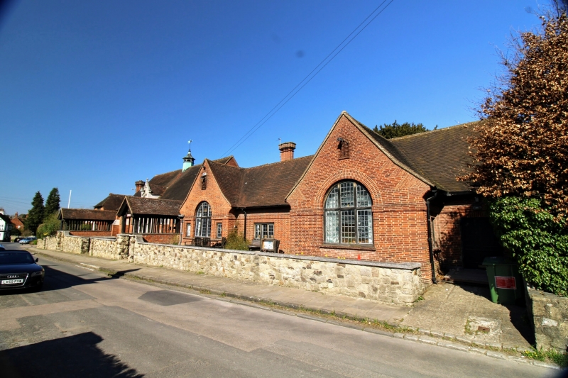
KEMSING KEMSING 5280 High Street (North Side) The St Edith's Hall TQ 5558 16/565 II 2. 1911 by Godfrey Pinkerton. Ambitious structure of 3 builds. All high pitched tiled roofs. Handmade red brick made interesting by bands of narrower bricks and tumbling in on gable ends. Tall, brick chimneys in C17 style. Oak framed and mullioned windows, those in centre part carved and with Tudor heads to lights. Main centre building higher than others, of one storey, 5 bays. Small cupola on ridge. Stepped buttresses. Central ashlar feature with figure of St Edith in niche. 2-storey, 3-bay residential left part. At right subsidiary hall of 3 wide bays, the outer ones projecting under gables. 2 long covered ways lead from street to entrance links.
Listing NGR: TQ5559358682
External links are from the relevant listing authority and, where applicable, Wikidata. Wikidata IDs may be related buildings as well as this specific building. If you want to add or update a link, you will need to do so by editing the Wikidata entry.


Other nearby listed buildings