Latitude: 51.3237 / 51°19'25"N
Longitude: -2.0163 / 2°0'58"W
OS Eastings: 398962
OS Northings: 158288
OS Grid: ST989582
Mapcode National: GBR 2V6.T8Q
Mapcode Global: VHB4G.0ZFM
Plus Code: 9C3V8XFM+FF
Entry Name: Stables at Manor House
Listing Date: 3 April 1987
Grade: II
Source: Historic England
Source ID: 1273052
English Heritage Legacy ID: 446643
ID on this website: 101273052
Location: Potterne, Wiltshire, SN10
County: Wiltshire
Civil Parish: Potterne
Traditional County: Wiltshire
Lieutenancy Area (Ceremonial County): Wiltshire
Tagged with: Stable
ST 9958 POTTERNE WORTON ROAD
14/178 Stables at Manor House
GV II
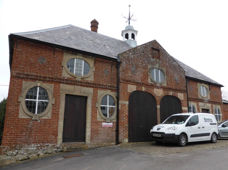
Stable block, 1800 using materials from demolished building of 1750, red brick with some diaper patterns, hipped slate roof and octagonal timber cupola with ogee-cap and large weathervane. Two storeys with projecting shallow-gabled centre and nogged brick band. Front has seven ashlar keyed oval lights variously dispersed, presumably reused, those to upper floor set horizontally with tripartite leaded lights, those on ground floor set vertically with leaded cross lights. Centre projection has blank panel in gable, first floor oval and 2 elliptical arched coach entries, with ashlar flush keystones and imposts. Sides each have one first floor centre oval and ground floor door in raised moulded stone surround with keystone, flanked by oval each side. Tudor-style brick chimney on rear roof slope. Rear wall has 4 cambered-head blank panels. The reused parts are said to have come from a folly called Maggot's Castle built at Easterton, Wilts in 1750.
Listing NGR: ST9896258288
External links are from the relevant listing authority and, where applicable, Wikidata. Wikidata IDs may be related buildings as well as this specific building. If you want to add or update a link, you will need to do so by editing the Wikidata entry.


Other nearby listed buildings