Latitude: 53.8622 / 53°51'43"N
Longitude: -2.1178 / 2°7'4"W
OS Eastings: 392346
OS Northings: 440669
OS Grid: SD923406
Mapcode National: GBR FRNS.98
Mapcode Global: WHB7S.F6Q0
Plus Code: 9C5VVV6J+VV
Entry Name: Rye Flat Farmhouse and Attached Barn
Listing Date: 29 January 1953
Grade: II
Source: Historic England
Source ID: 1272943
English Heritage Legacy ID: 186256
ID on this website: 101272943
Location: Laneshaw Bridge, Pendle, Lancashire, BB8
County: Lancashire
District: Pendle
Civil Parish: Laneshaw Bridge
Traditional County: Lancashire
Lieutenancy Area (Ceremonial County): Lancashire
Church of England Parish: Colne Christ Church
Church of England Diocese: Blackburn
Tagged with: Farmhouse
SD 94 SW COLNE SCHOOL LANE Laneshaw Bridge 8/106 Rye Flat Farmhouse and 29.1.53 attached barn
- II
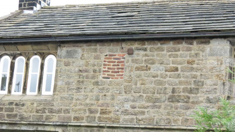
House and barn in one range. Probably later C17 or early C18. Stone. Stone slate roof. Stone coping and moulded kneelers. 2 storeys. One 4-light and one 3-light chamfered, stone mullion window. Moulded dripstone extended as string. Two 4-light mullion windows on 1st floor with semicircular heads. Doorway has moulded Tudor-arched head. Blocked doorway to right. Barn to right under same roof. Plain doorway, small square window to right. Several walled-up openings. Farmhouse reputed to have been public house.
Listing NGR: SD9234640669
External links are from the relevant listing authority and, where applicable, Wikidata. Wikidata IDs may be related buildings as well as this specific building. If you want to add or update a link, you will need to do so by editing the Wikidata entry.


Other nearby listed buildings