Latitude: 51.346 / 51°20'45"N
Longitude: -2.1241 / 2°7'26"W
OS Eastings: 391454
OS Northings: 160781
OS Grid: ST914607
Mapcode National: GBR 1SJ.HT1
Mapcode Global: VH96Y.4FFG
Plus Code: 9C3V8VWG+C9
Entry Name: Seend Park Farmhouse
Listing Date: 3 April 1987
Grade: II
Source: Historic England
Source ID: 1272827
English Heritage Legacy ID: 447363
ID on this website: 101272827
Location: Littleton, Wiltshire, BA14
County: Wiltshire
Civil Parish: Seend
Built-Up Area: Seend Cleeve
Traditional County: Wiltshire
Lieutenancy Area (Ceremonial County): Wiltshire
Tagged with: Farmhouse
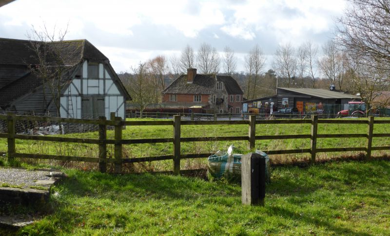
SEEND - ST 96 SW 3/257 Seend Park Farmhouse II Farmhouse, mid C18 refronting of C17 timber-framed building. Red brick with ashlar dressings and stone slate roof, half-hipped to west, hipped at south-east angle. Two storeys, 3-window range, L- plan. Front has flush quoins, chequered brickwork, ashlar plinth and dripcourse. Cyma-moulded flush stone mullion windows, 3-light each side, 2-light to first floor centre over door in flush moulded surround under hipped stone slate hood. Quoin at south-east angle is dated TR 1766. Rear wing has ridge stack and 2-window range of similar 3-light windows, one replaced by C20 window. Rear wall is timber-framed, obscured by lean-to and interior has heavy chamfered beams throughout. House is recorded from 1632. Thomas Rutty is recorded as owner in later C18. (E. Bradby, Seend A Wiltshire Village, 1981, 199; E. Bradby Seend Heritage, 1985, 34.
Listing NGR: ST9145460781
External links are from the relevant listing authority and, where applicable, Wikidata. Wikidata IDs may be related buildings as well as this specific building. If you want to add or update a link, you will need to do so by editing the Wikidata entry.


Other nearby listed buildings