Latitude: 51.3336 / 51°20'0"N
Longitude: 0.1815 / 0°10'53"E
OS Eastings: 552070
OS Northings: 161644
OS Grid: TQ520616
Mapcode National: GBR T1.VTV
Mapcode Global: VHHPD.3RB2
Plus Code: 9F3285MJ+CJ
Entry Name: Bridge Cottage
Listing Date: 16 January 1975
Grade: II
Source: Historic England
Source ID: 1272700
English Heritage Legacy ID: 447975
ID on this website: 101272700
Location: Shoreham, Sevenoaks, Kent, TN14
County: Kent
District: Sevenoaks
Civil Parish: Shoreham
Built-Up Area: Shoreham
Traditional County: Kent
Lieutenancy Area (Ceremonial County): Kent
Church of England Parish: Shoreham St Peter and St Paul
Church of England Diocese: Rochester
Tagged with: Cottage
1. 5280 SHOREHAM SHOREHAM Church Street (North Side)
Bridge Cottage TQ 5261 31/1167
II GV
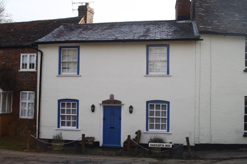
2. C18 symmetrical rendered elevation of 2 storeys with projecting eaves and gutter and slate roof. 4 sash windows with glazing bars in exposed frames. Centre C19 panelled door.
Waterfall Cottage, Ivy Cottage, Riverside House, Rising Sun and Bridge Cottage form a group.
Listing NGR: TQ5207061644
External links are from the relevant listing authority and, where applicable, Wikidata. Wikidata IDs may be related buildings as well as this specific building. If you want to add or update a link, you will need to do so by editing the Wikidata entry.


Other nearby listed buildings