Latitude: 51.4725 / 51°28'21"N
Longitude: -0.1645 / 0°9'52"W
OS Eastings: 527577
OS Northings: 176439
OS Grid: TQ275764
Mapcode National: GBR 7V.79
Mapcode Global: VHGR5.37CZ
Plus Code: 9C3XFRFP+25
Entry Name: Dovedale Cottages
Listing Date: 6 September 1994
Grade: II
Source: Historic England
Source ID: 1272408
English Heritage Legacy ID: 449366
ID on this website: 101272408
Location: Battersea, Wandsworth, London, SW11
County: London
District: Wandsworth
Electoral Ward/Division: Latchmere
Parish: Non Civil Parish
Built-Up Area: Wandsworth
Traditional County: Surrey
Lieutenancy Area (Ceremonial County): Greater London
Church of England Parish: Battersea Christ Church and St Stephen
Church of England Diocese: Southwark
Tagged with: Cottage
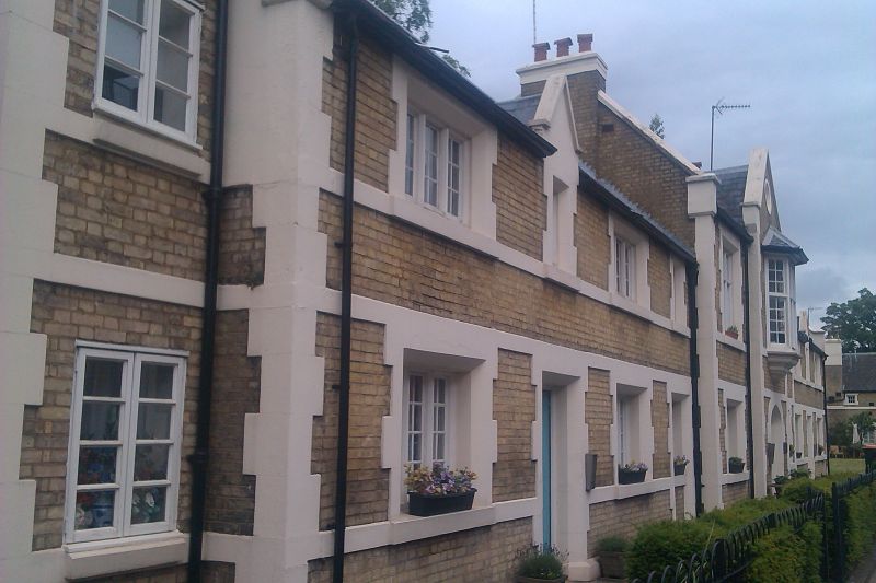
BATTERSEA PARK ROAD TQ 2776 (North side) 1207- /7/10029 Nos.2-11 (Consecutive) Dovedale Cottages II GV Almshouses, now arranged as flats. 1841 on behalf of Mrs Lightfoot and her daughter, Mary, for'persons in reduced circumstances professing godliness'. White brick in Flemish bond with cement dressings and slate roofs. Two storeys. Three-part symmetrical composition with projecting centre section of three windows originally containing chapel and taller than its surrounds. Entrance to No. 6 in this range is set under a four-centred Tudor arch, other openings are flat arched. Two entrances to each lower wing on street facade with single light windows on first-floor over, those nearest ends in dormers. The other windows are three-light casements set in narrow mullions forming an alternating pattern to the first floor, except that first-floor windows of centre block have mullions and a transom; the window over centre entrance is an oriel, above which is a gable inset with roundel depicting a dove bearing an olive branch. Apart from the central gable over the former chapel, the roof is gabled to the returns and has boxed eaves to the front wall. Lintel band to ground floor. Sill band to first floor. The fire wall of centre range has its own parapet and coping above that of side ranges, where the gables also finish in a parapet with coping. There are two stacks to each low side wing: one to the peak of the parapet, the other near the fire wall of the centre range. The stacks to the latter range are set in its parapet end walls. This range forms the centrepiece of the group of almshouses, which form a distinguished composition alongside the former St Stephen's church (q.v.)
Listing NGR: TQ2757776439
External links are from the relevant listing authority and, where applicable, Wikidata. Wikidata IDs may be related buildings as well as this specific building. If you want to add or update a link, you will need to do so by editing the Wikidata entry.


Other nearby listed buildings