Latitude: 51.8615 / 51°51'41"N
Longitude: -2.25 / 2°14'59"W
OS Eastings: 382881
OS Northings: 218136
OS Grid: SO828181
Mapcode National: GBR 1L5.7YX
Mapcode Global: VH94B.YGDS
Plus Code: 9C3VVQ62+J2
Entry Name: The Whitesmiths Arms
Listing Date: 15 December 1998
Grade: II
Source: Historic England
Source ID: 1271772
English Heritage Legacy ID: 472502
Also known as: Whitesmiths Arms
Whitesmiths Arms, Gloucester
ID on this website: 101271772
Location: High Orchard, Gloucester, Gloucestershire, GL1
County: Gloucestershire
District: Gloucester
Electoral Ward/Division: Westgate
Parish: Non Civil Parish
Built-Up Area: Gloucester
Traditional County: Gloucestershire
Lieutenancy Area (Ceremonial County): Gloucestershire
Church of England Parish: St James and All Saints, Gloucester
Church of England Diocese: Gloucester
Tagged with: Pub
GLOUCESTER
SO8218SE SOUTHGATE STREET 844-1/11/276 (East side) No.81 The Whitesmiths Arms
GV II
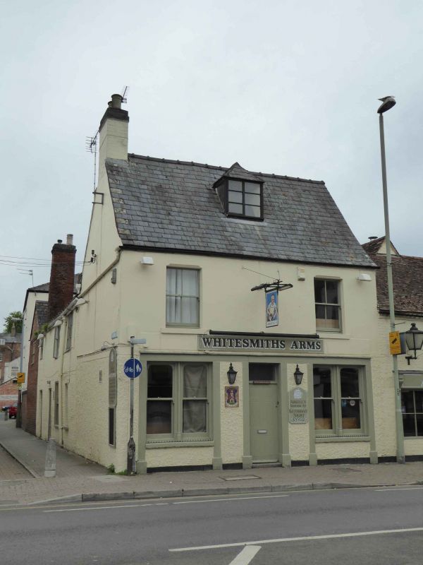
House, now public house. C18 with C19 alterations but probably encapsulating parts of an earlier building. Brick, partly rendered in pebble dash, slate roof with a single hipped dormer, brick stacks. Single depth end-gabled parallel block with stack to left gable and rear wing to left in Albion Street. EXTERIOR: two storeys, attic and cellar; symmetrical front remodelled c1870; central entrance doorway with rectangular fanlight and to either side a recess enclosing a pair of horned sashes; the doorway and both recesses framed by plain pilasters supporting a continuous architrave with a cornice moulding; on the first floor at each end a sash with a single vertical glazing bar in openings with projecting stone sills and in the centre above the doorway an inn sign hanging from a metal bracket; in the roof dormer a pair of casements with glazing bars. The north wall of the rear wing in Albion Street has irregular fenestration including, on the ground floor, a C18 sash with glazing bars. INTERIOR: some indications of residual timber-framing. Prominently sited to east of The Docks (qv).
Listing NGR: SO8288118136
External links are from the relevant listing authority and, where applicable, Wikidata. Wikidata IDs may be related buildings as well as this specific building. If you want to add or update a link, you will need to do so by editing the Wikidata entry.


Other nearby listed buildings