Latitude: 51.8639 / 51°51'49"N
Longitude: -2.2501 / 2°15'0"W
OS Eastings: 382875
OS Northings: 218393
OS Grid: SO828183
Mapcode National: GBR 1L5.1Y3
Mapcode Global: VH94B.YFB0
Plus Code: 9C3VVP7X+GX
Entry Name: Regiments of Gloucestershire Museum
Listing Date: 12 March 1973
Last Amended: 15 December 1998
Grade: II
Source: Historic England
Source ID: 1271653
English Heritage Legacy ID: 472189
ID on this website: 101271653
Location: Gloucester, Gloucestershire, GL1
County: Gloucestershire
District: Gloucester
Electoral Ward/Division: Westgate
Parish: Non Civil Parish
Built-Up Area: Gloucester
Traditional County: Gloucestershire
Lieutenancy Area (Ceremonial County): Gloucestershire
Church of England Parish: Hempsted with Gloucester, Saint Mary de Lode and Saint Mary de Crypt
Church of England Diocese: Gloucester
Tagged with: Museum building
GLOUCESTER
SO8218SE COMMERCIAL ROAD 844-1/11/99 (South side) 12/03/73 No.31 Regiments of Gloucestershire Museum (Formerly Listed as: COMMERCIAL ROAD (South side) Custom House)
GV II
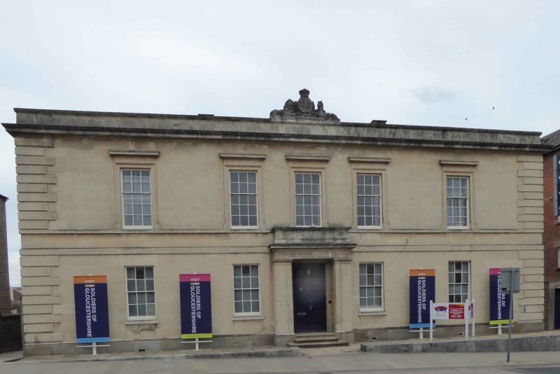
HM Custom and Excise Office, now museum. Completed 1845, by Sydney Smirke for the Customs Commissioners. Minor alterations c1985 for conversion as the Regiments of Gloucestershire Museum. Ashlar to front and sides, brick at rear, slate roof, brick stack. Symmetrical double-depth block; the C20 entrance to museum at rear is approached from the Docks. EXTERIOR: two storeys and basement. Symmetrical front to Commercial Road; offset plinth, raised bands at first floor and first-floor sill levels, crowning cornice and a coped parapet; at the outer corners between the plinth and the first-floor band, and between the first-floor sill band and the crowning cornice, are long raised and chamfered quoins. On the ground floor in the centre a porch of slight projection, the open front framed by pilasters and entablature with parapet above; flanking the porch on either side a sash with a further sash widely spaced to left and right in plain openings with projecting stone sills. On the first floor the same pattern of openings with three closely spaced sashes in the centre and a architraves and floating cornices. All the sashes with glazing bars (3x4 panes). Set above the centre of the parapet the royal arms carved in stone. Elevation at each end has three sashes on each floor with details are similar to the front. Rear elevation facing the Docks of brick, with late C20 glazed extension. INTERIOR: not inspected HISTORY: built in order to handle the great expansion of foreign trade passing through Gloucester Docks in the second half of the nineteenth century.
Listing NGR: SO8287518393
External links are from the relevant listing authority and, where applicable, Wikidata. Wikidata IDs may be related buildings as well as this specific building. If you want to add or update a link, you will need to do so by editing the Wikidata entry.


Other nearby listed buildings