Latitude: 52.7066 / 52°42'23"N
Longitude: -2.7476 / 2°44'51"W
OS Eastings: 349583
OS Northings: 312362
OS Grid: SJ495123
Mapcode National: GBR BJ.2J8M
Mapcode Global: WH8BT.R7TD
Plus Code: 9C4VP742+JX
Entry Name: English Bridge at SJ 496 123
Listing Date: 10 January 1953
Grade: II*
Source: Historic England
Source ID: 1271479
English Heritage Legacy ID: 454641
Also known as: English Bridge, Shrewsbury
ID on this website: 101271479
Location: Coleham, Shropshire, SY1
County: Shropshire
Civil Parish: Shrewsbury
Built-Up Area: Shrewsbury
Traditional County: Shropshire
Lieutenancy Area (Ceremonial County): Shropshire
Church of England Parish: Shrewsbury St Chad
Church of England Diocese: Lichfield
Tagged with: Road bridge
SHREWSBURY
SJ4912SE English Bridge at SJ 496 123 653-1/16/1 10/01/53
GV II*
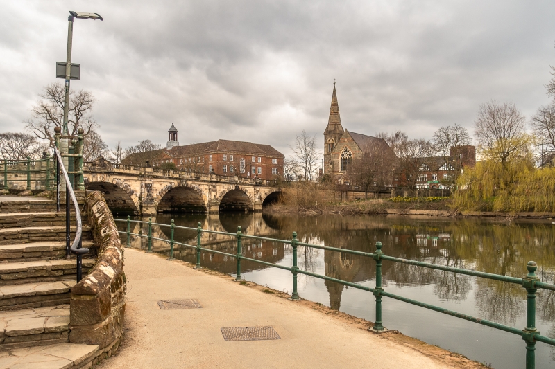
Bridge over River Severn. 1769, rebuilt 1926. Original design by John Gwynn. Ashlar. 7-arch span, with pilasters and cutwaters between the arches. Rusticated voussoirs to shallow segmental arches, and stressed keystones with shell motifs. Central arch emphasised with dolphins carved on the cutwaters, and a head of Neptune on the keystone. Balustraded parapet with solid panels over each pilaster carrying ball finials, and over the centres of the arches, carrying cast-iron lamp standards. Central panel has pediment, with date and Salop arms on outer face, inscribed with details of construction and reconstruction on inner face. Curved flight of steps to north west leads from road to river level.
Listing NGR: SJ4958312362
External links are from the relevant listing authority and, where applicable, Wikidata. Wikidata IDs may be related buildings as well as this specific building. If you want to add or update a link, you will need to do so by editing the Wikidata entry.


Other nearby listed buildings