The listing was removed on 23 January 2015.
This building has been assessed for de-listing under the Planning (Listed Buildings and Conservation Areas) Act 1990 as amended. The building has been removed from The National Heritage List for England as it no longer meets the criteria for listing.
The information below has been retained for archive purposes. It does not necessarily reflect the current state of the building.
Latitude: 53.3433 / 53°20'35"N
Longitude: -1.6086 / 1°36'30"W
OS Eastings: 426157
OS Northings: 383000
OS Grid: SK261830
Mapcode National: GBR KY6S.J7
Mapcode Global: WHCCP.878B
Plus Code: 9C5W89VR+8H
Entry Name: Upper Burbage Bridge (East)
Listing Date: 12 December 1995
Delisted Date: 23 January 2015
Grade: II
Source: Historic England
Source ID: 1271039
English Heritage Legacy ID: 456283
ID on this website: 101271039
Location: Derbyshire Dales, Derbyshire, S32
County: Derbyshire
District: Derbyshire Dales
Civil Parish: Hathersage
Traditional County: Derbyshire
Lieutenancy Area (Ceremonial County): South Yorkshire
Church of England Parish: Hathersage St Michael and All Angels
Church of England Diocese: Derby
Tagged with: Road bridge
SK28SE
784-1/8/619
RINGINGLOW ROAD
Upper Burbage Bridge (east)
GV
II
This asset was subject to a minor amendment on 23/01/2015.
The asset was previously listed under List entry 1269056. This entry was removed from the List on 23/01/2015.
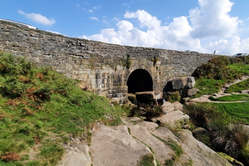
Turnpike road bridge spanning a tributary of the Burbage Brook. c1750. Ashlar and coursed squared stone. Single round arch with large spandrel walls and plain parapet with slab coping. Approx 80m east of the west bridge (qv).
Listing NGR: SK2615783000
External links are from the relevant listing authority and, where applicable, Wikidata. Wikidata IDs may be related buildings as well as this specific building. If you want to add or update a link, you will need to do so by editing the Wikidata entry.


Other nearby listed buildings