Latitude: 52.2269 / 52°13'36"N
Longitude: -2.7422 / 2°44'31"W
OS Eastings: 349399
OS Northings: 259007
OS Grid: SO493590
Mapcode National: GBR FK.1SGK
Mapcode Global: VH84W.F945
Plus Code: 9C4V67G5+Q4
Entry Name: 7, 9 and 11, Bargates
Listing Date: 24 July 1954
Last Amended: 15 March 1996
Grade: II
Source: Historic England
Source ID: 1270370
English Heritage Legacy ID: 459556
ID on this website: 101270370
Location: Leominster, County of Herefordshire, HR6
County: County of Herefordshire
Civil Parish: Leominster
Built-Up Area: Leominster
Traditional County: Herefordshire
Lieutenancy Area (Ceremonial County): Herefordshire
Church of England Parish: Leominster
Church of England Diocese: Hereford
Tagged with: Building
LEOMINSTER
SO4959 BARGATES 808-1/1/5 (South side) 24/07/54 Nos.7, 9 AND 11 (Formerly Listed as: BARGATES No.11)
GV II
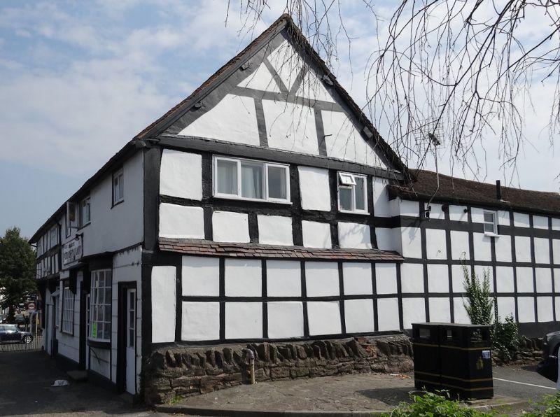
Houses, now shop and dwellings. C17 with C19 alterations. Timber-frame and plaster; roughcast; stucco, rusticated to ground floor; plain tile roof with old tiles to rear; small C20(?) stack to rear. 4 bay plan. 2 storeys; 5-window range: C20 casements. Various C20 doors, 2 to right in moulded architraves, flanking C19 bow-window with moulded glazing bars, fascia and pilasters; to left, C19 fixed light with moulded glazing bars, plain architrave and flat hood; C20 fixed light. 2 left-hand bays jettied on curved chamfered brackets; right-hand bays probably underbuilt, early C19. Left returned side: plastered gable; pentice-board over timber-framing; shallow C19 timber-framed element under plain tiled pentice roof, to ground floor. INTERIOR: ogee-stop chamfered ceiling frame. (RCHME: Herefordshire: 126 (160)(161)).
Listing NGR: SO4939959007
External links are from the relevant listing authority and, where applicable, Wikidata. Wikidata IDs may be related buildings as well as this specific building. If you want to add or update a link, you will need to do so by editing the Wikidata entry.


Other nearby listed buildings