Latitude: 52.2292 / 52°13'45"N
Longitude: -2.7371 / 2°44'13"W
OS Eastings: 349750
OS Northings: 259257
OS Grid: SO497592
Mapcode National: GBR FK.1MPG
Mapcode Global: VH84W.H7VF
Plus Code: 9C4V67H7+M5
Entry Name: Community Centre
Listing Date: 9 July 1976
Last Amended: 15 March 1996
Grade: II
Source: Historic England
Source ID: 1270285
English Heritage Legacy ID: 459767
ID on this website: 101270285
Location: Leominster, County of Herefordshire, HR6
County: County of Herefordshire
Civil Parish: Leominster
Built-Up Area: Leominster
Traditional County: Herefordshire
Lieutenancy Area (Ceremonial County): Herefordshire
Church of England Parish: Leominster
Church of England Diocese: Hereford
Tagged with: Architectural structure
LEOMINSTER
SO4959 SCHOOL ROAD 808-1/1/186 (North West side) 09/07/76 Community Centre (Formerly Listed as: SCHOOL LANE Leominster Junior School)
GV II
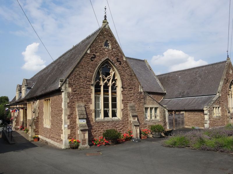
School, now community centre. Mid C19. Sandstone rubble with ashlar detailing; Welsh slate roof; brick stacks to rear. H-shaped on plan, with irregular wings to rear. Single storey; 4-window range: 2 central square-headed 3-light mullions with Gothic tracery, under ashlar hood mouldings. Advanced wings have 3-light mullions with Gothic tracery under pointed arches with hood moulding. Lean-tos with 3-light mullions; buttresses; stone-coped gable parapets; 2 roof dormers with 3-light stone mullion windows under rubble gables. Left returned side: various fixed lights and 3-light mullions; C20 half-glazed panelled door and barred overlight; stepped buttresses. Rear: Schoolmaster's house with porch to main range. INTERIOR not inspected.
Listing NGR: SO4975059260
External links are from the relevant listing authority and, where applicable, Wikidata. Wikidata IDs may be related buildings as well as this specific building. If you want to add or update a link, you will need to do so by editing the Wikidata entry.


Other nearby listed buildings