Latitude: 50.1474 / 50°8'50"N
Longitude: -5.0477 / 5°2'51"W
OS Eastings: 182356
OS Northings: 31933
OS Grid: SW823319
Mapcode National: GBR ZG.4WST
Mapcode Global: FRA 089M.R8W
Plus Code: 9C2P4XW2+XW
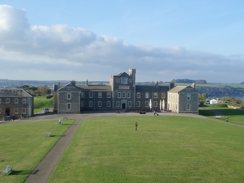
Entry Name: The Barrack Block, Pendennis Castle
Listing Date: 21 January 1973
Last Amended: 24 April 1996
Grade: II
Source: Historic England
Source ID: 1270100
English Heritage Legacy ID: 460095
ID on this website: 101270100
Location: Cornwall, TR11
County: Cornwall
Civil Parish: Falmouth
Traditional County: Cornwall
Lieutenancy Area (Ceremonial County): Cornwall
Church of England Parish: Budock
Church of England Diocese: Truro
Tagged with: Barracks
FALMOUTH
SW83SW CASTLE DRIVE 843-1/2/48 The Barrack Block, Pendennis Castle 21/01/73 (Formerly Listed as: Pendennis Castle)
GV II
Barracks, now used as hostel and cafe. 1901. Killas rubble with granite dressings including plinth coping; dry Delabole slate roofs. Large symmetrical E-shaped plan. 2 storeys; symmetrical 1:4:3:4:1-window front plus 5-window returns inside wings. Original horned sashes with glazing bars. Central 3-storey entrance porch/clock tower with stepped hood-mould to eaves level and to parapet over central clockface; embattled octagonal stair turret behind parapet on the right; date panel above lower hood-mould. Central segmental-arched doorway. Other elevations with similar details. INTERIOR where inspected is very plain.
Listing NGR: SW8235631933
External links are from the relevant listing authority and, where applicable, Wikidata. Wikidata IDs may be related buildings as well as this specific building. If you want to add or update a link, you will need to do so by editing the Wikidata entry.


Other nearby listed buildings