Latitude: 50.1534 / 50°9'12"N
Longitude: -5.0744 / 5°4'27"W
OS Eastings: 180478
OS Northings: 32673
OS Grid: SW804326
Mapcode National: GBR ZD.TG82
Mapcode Global: FRA 088M.0Y8
Plus Code: 9C2P5W3G+97
Entry Name: 66, Killigrew Street
Listing Date: 24 April 1996
Grade: II
Source: Historic England
Source ID: 1270047
English Heritage Legacy ID: 460169
ID on this website: 101270047
Location: Falmouth, Cornwall, TR11
County: Cornwall
Civil Parish: Falmouth
Built-Up Area: Falmouth
Traditional County: Cornwall
Lieutenancy Area (Ceremonial County): Cornwall
Church of England Parish: Falmouth All Saints
Church of England Diocese: Truro
Tagged with: Building
FALMOUTH
SW8032NW KILLIGREW STREET 843-1/6/131 (North West side) No.66
GV II
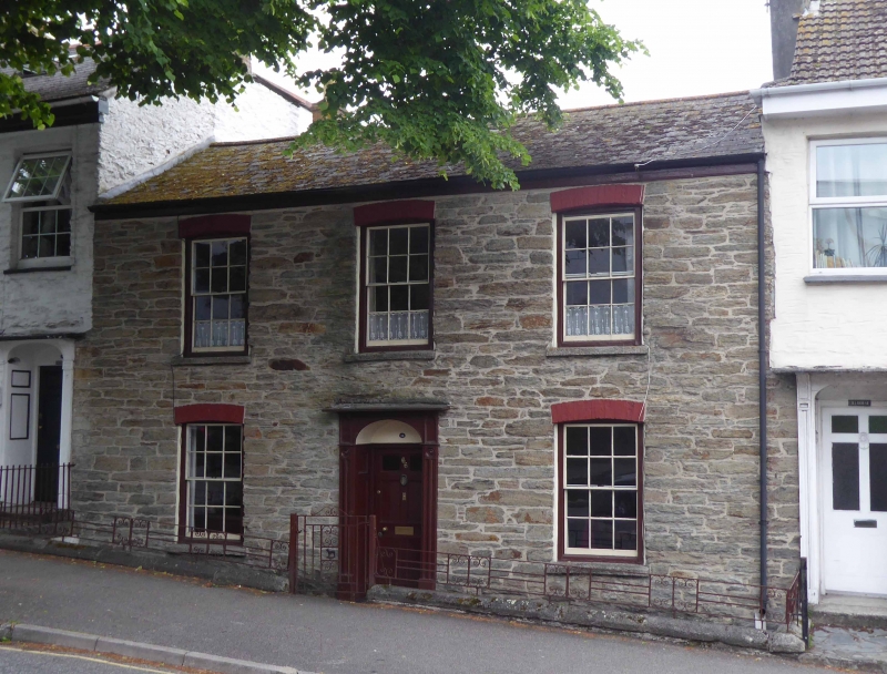
House in row. Early C19. Killas rubble with shallow segmental brick arches; original scantle slate roof; heightened shared brick end stacks. Double-depth plan. 2 storeys; symmetrical 3-window front with original 12-pane hornless sashes. Original elliptical-arched doorcase with moulded pilasters, roundels to corner blocks, blind fanlight and 6-panel door with top 2 panels later glazed. INTERIOR not inspected but likely to be as unaltered as the exterior.
Listing NGR: SW8047832673
External links are from the relevant listing authority and, where applicable, Wikidata. Wikidata IDs may be related buildings as well as this specific building. If you want to add or update a link, you will need to do so by editing the Wikidata entry.


Other nearby listed buildings