Latitude: 50.1561 / 50°9'22"N
Longitude: -5.0712 / 5°4'16"W
OS Eastings: 180715
OS Northings: 32970
OS Grid: SW807329
Mapcode National: GBR ZD.T92Q
Mapcode Global: FRA 088L.VJ8
Plus Code: 9C2P5W4H+FG
Entry Name: 6 and 7, Market Strand
Listing Date: 15 October 1971
Grade: II
Source: Historic England
Source ID: 1270015
English Heritage Legacy ID: 460180
ID on this website: 101270015
Location: Falmouth, Cornwall, TR11
County: Cornwall
Civil Parish: Falmouth
Built-Up Area: Falmouth
Traditional County: Cornwall
Lieutenancy Area (Ceremonial County): Cornwall
Church of England Parish: Falmouth All Saints
Church of England Diocese: Truro
Tagged with: Building
FALMOUTH
SW8032NE MARKET STRAND 843-1/7/150 (West side) 15/10/71 Nos.6 AND 7
GV II
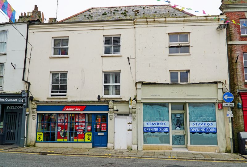
Two town houses with later shops. Probably late C18, refronted mid C19. Incised stucco on right, replaced with render on left; moulded parapet cornice; dry slate hipped roof; rendered end stack on left. Double-depth plan plus deep wings at rear left and right. 3 storeys; 3-window range with No.6 (left) a single-window range with its front broken forward. Late C19 4-pane horned sashes to No.7; C20 windows to No.6. Ground floor has 2 late C19 shop fronts with end pilasters and consoles rising through moulded entablature with fascia, both with altered shop windows. No.7 with small panes and doorway on the right; No.6 is a taller double shop front. House doorway between shops with squat fanlight over panelled door. INTERIOR not inspected.
Listing NGR: SW8071532970
External links are from the relevant listing authority and, where applicable, Wikidata. Wikidata IDs may be related buildings as well as this specific building. If you want to add or update a link, you will need to do so by editing the Wikidata entry.


Other nearby listed buildings