Latitude: 52.4316 / 52°25'53"N
Longitude: -2.7762 / 2°46'34"W
OS Eastings: 347320
OS Northings: 281795
OS Grid: SO473817
Mapcode National: GBR BH.MWQR
Mapcode Global: VH76F.T4PS
Plus Code: 9C4VC6JF+JG
Entry Name: The Tower House
Listing Date: 21 June 1996
Grade: II
Source: Historic England
Source ID: 1269918
English Heritage Legacy ID: 460293
ID on this website: 101269918
Location: Burley, Shropshire, SY7
County: Shropshire
Civil Parish: Culmington
Traditional County: Shropshire
Lieutenancy Area (Ceremonial County): Shropshire
Church of England Parish: Culmington
Church of England Diocese: Hereford
Tagged with: House
CULMINGTON
SO48SE BURLEY 1943-1/1/6 The Tower House
II
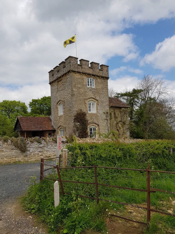
Folly. C19. Sandstone rubble; probably lead roof; stack not visible. Irregular plan, with 2 towers, wing and lean-tos. EXTERIOR: 3 storeys; single-window range: 2-light casement under hood moulding to ground and first floors; 3-light casement over; corbel-table to castellated parapet. Entrances in porch to left returned side, and in wing to right. INTERIOR: not inspected.
Listing NGR: SO4732081795
External links are from the relevant listing authority and, where applicable, Wikidata. Wikidata IDs may be related buildings as well as this specific building. If you want to add or update a link, you will need to do so by editing the Wikidata entry.


Other nearby listed buildings