Latitude: 51.5867 / 51°35'12"N
Longitude: -2.1022 / 2°6'7"W
OS Eastings: 393018
OS Northings: 187544
OS Grid: ST930875
Mapcode National: GBR 2QZ.HBB
Mapcode Global: VH95S.JC1Z
Plus Code: 9C3VHVPX+M4
Entry Name: 40, Horsefair
Listing Date: 1 July 1976
Grade: II
Source: Historic England
Source ID: 1269306
English Heritage Legacy ID: 460886
ID on this website: 101269306
Location: Malmesbury, Wiltshire, SN16
County: Wiltshire
Civil Parish: Malmesbury
Built-Up Area: Malmesbury
Traditional County: Wiltshire
Lieutenancy Area (Ceremonial County): Wiltshire
Church of England Parish: Malmesbury and Brokenborough
Church of England Diocese: Bristol
Tagged with: Building
MALMESBURY
ST9387 HORSEFAIR 758-1/2/223 (North side) 01/07/76 No.40
GV II
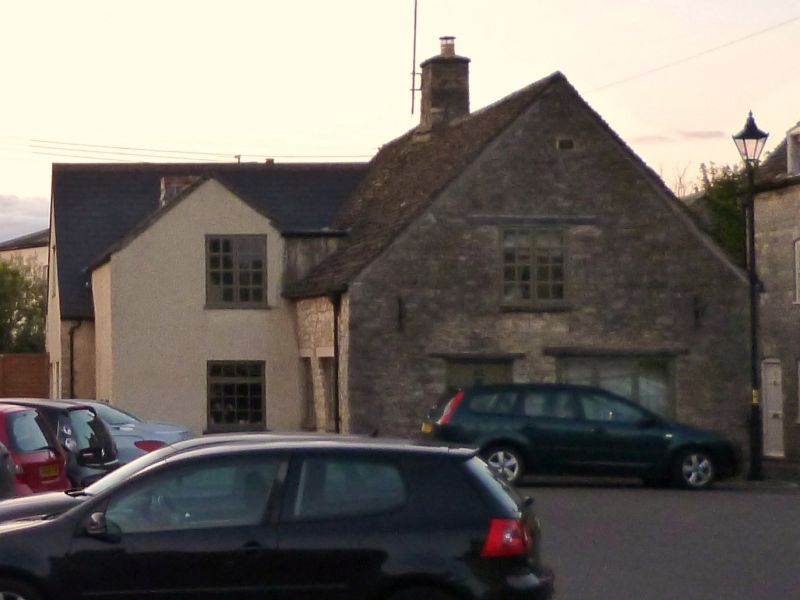
Pair of houses, now one shop. Mid C18. Coursed limestone, formerly limewashed, stone ridge stack and stone slate roof. Each a single-room plan. Single storey and attic; 1-window range. The S gable has timber lintels to a left-hand doorway and C20 door, C20 shop front and central attic casement; the right-hand side has timber lintels to a blocked left of centre doorway, a right-hand window and central gabled dormer. Left-hand extension. INTERIOR: altered ground floor; details include a winder stair to the side of the central fireplace, which has a bressumer in the first-floor front room, and chamfered ceiling beams.
Listing NGR: ST9301587548
External links are from the relevant listing authority and, where applicable, Wikidata. Wikidata IDs may be related buildings as well as this specific building. If you want to add or update a link, you will need to do so by editing the Wikidata entry.


Other nearby listed buildings