Latitude: 51.806 / 51°48'21"N
Longitude: -1.6377 / 1°38'15"W
OS Eastings: 425076
OS Northings: 211996
OS Grid: SP250119
Mapcode National: GBR 5SW.LSY
Mapcode Global: VHBZS.KVKV
Plus Code: 9C3WR946+CW
Entry Name: Glenthorne House
Listing Date: 12 September 1955
Last Amended: 1 March 1990
Grade: II
Source: Historic England
Source ID: 1266657
English Heritage Legacy ID: 420885
ID on this website: 101266657
Location: Burford, West Oxfordshire, OX18
County: Oxfordshire
District: West Oxfordshire
Civil Parish: Burford
Built-Up Area: Burford
Traditional County: Oxfordshire
Lieutenancy Area (Ceremonial County): Oxfordshire
Church of England Parish: Burford
Church of England Diocese: Oxford
Tagged with: House
BURFORD AND UPTON HIGH STREET AND SIGNET (West side) SP2411-2511; SP2512(Enlargement) No 174 (Glenthorne 6/164; 7/164 House) (previously 12.9.55 listed as Glenthorne)
GV II
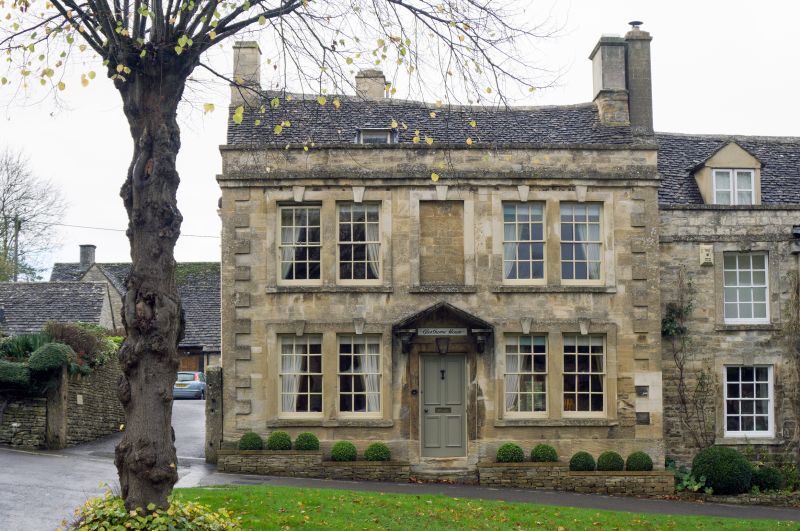
House. C14 remodelled C17 with perhaps mid-C19 front in C18 style (attributed to Christopher Kempster). Freestone front with plain ashlar raised quoins, otherwise rubble, Cotswold stone roofs, ashlar end chimneys. Front: 2 storeys with parapet, stands on plinth. 3 bays, with parapet, stands on plinth. 3 bays, outer paired, glazing-bar sashes in raised flat surrounds with cock-beads and keystones, simple offset courses as cornice. Central 4-panel door with stone brackets to flat hood. Gabled stair-turret adjacent to south gable return and lower 1- and 2- storey mullion windowed extensions. Internal evidence of former double gabled frontage. Interior: late C14 small pointed doorway axial with entrance, wave moulding; late mediaeval fireplace with moulded corbels to simple hood; bressumer on North side moulded and has traces of painted decoration; double-chamfered floor joists; newel stair in turret; remains of Jacobean panelling on 1st floor landing. The Kempster attribution is unlikely. As late as 1761 still an Inn (The Star Inn); cobbles found below right-hand bay suggest a coach- entry there (ex.inf R Moody).
Listing NGR: SP2507611996
External links are from the relevant listing authority and, where applicable, Wikidata. Wikidata IDs may be related buildings as well as this specific building. If you want to add or update a link, you will need to do so by editing the Wikidata entry.


Other nearby listed buildings