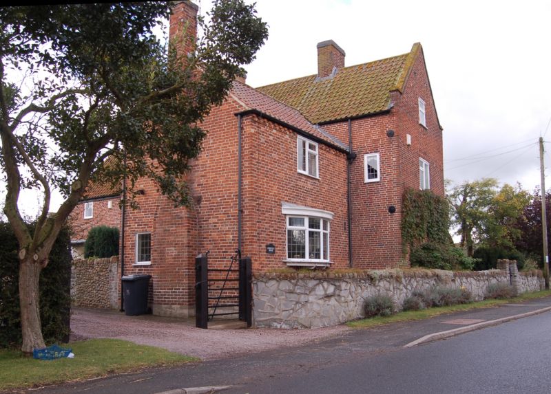
Latitude: 52.8535 / 52°51'12"N
Longitude: -0.9749 / 0°58'29"W
OS Eastings: 469124
OS Northings: 328942
OS Grid: SK691289
Mapcode National: GBR BMT.0CH
Mapcode Global: WHFJL.0J1R
Plus Code: 9C4XV23G+C2
Entry Name: Chestnut House
Listing Date: 25 September 1979
Grade: II
Source: Historic England
Source ID: 1265244
English Heritage Legacy ID: 425589
ID on this website: 101265244
Location: Hickling, Rushcliffe, Nottinghamshire, LE14
County: Nottinghamshire
District: Rushcliffe
Civil Parish: Hickling
Built-Up Area: Hickling
Traditional County: Nottinghamshire
Lieutenancy Area (Ceremonial County): Nottinghamshire
Church of England Parish: Hickling
Church of England Diocese: Southwell and Nottingham
Tagged with: House
HICKLING MAIN STREET SK62NE (east side) 6/67 Chestnut House 25.9.79 - II House. Early C18 with large C19 additions. Brick. Steeply pitched pantile roof with gable copings. One ridge stack and one end stack to right. Two-bay range with lower addition to right and lower rear wing. Two storeys, the main range with garrets. The front has a C19 canted, ground-floor bay to left and a later bay to right which incorporates an open porch to the near-central doorway. Above this and integral with it, is a lst-floor bow. Garret windows in gable ends. The rear wing has a later ground floor bow. Interior: not inspected.
Listing NGR: SK6912428942
External links are from the relevant listing authority and, where applicable, Wikidata. Wikidata IDs may be related buildings as well as this specific building. If you want to add or update a link, you will need to do so by editing the Wikidata entry.


Other nearby listed buildings