Latitude: 53.0546 / 53°3'16"N
Longitude: -1.2047 / 1°12'17"W
OS Eastings: 453400
OS Northings: 351110
OS Grid: SK534511
Mapcode National: GBR 8GB.G76
Mapcode Global: WHDGC.GHJ4
Plus Code: 9C5W3Q3W+R4
Entry Name: Hall Farmhouse and Adjoining Hall Farm Cottage and Boundary Wall
Listing Date: 13 October 1966
Grade: II
Source: Historic England
Source ID: 1264598
English Heritage Legacy ID: 425326
ID on this website: 101264598
Location: Linby, Gedling, Nottinghamshire, NG15
County: Nottinghamshire
District: Gedling
Civil Parish: Linby
Built-Up Area: Hucknall
Traditional County: Nottinghamshire
Lieutenancy Area (Ceremonial County): Nottinghamshire
Church of England Parish: Linby with Papplewick
Church of England Diocese: Southwell and Nottingham
Tagged with: Farmhouse
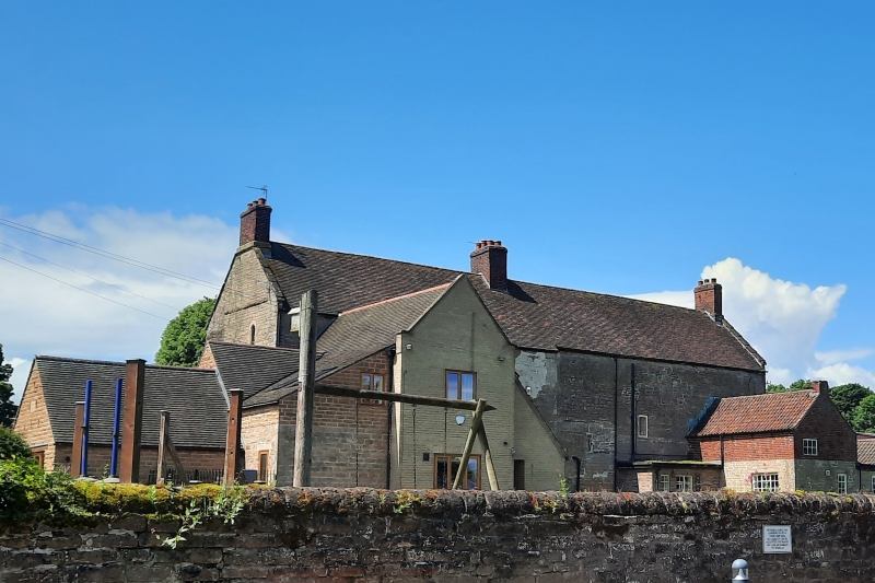
LINBY HALL LANE SK 55 SW (east side) 1/76 Hall Farmhouse and adjoining Hall Farm Cottage and boundary 13.10.66 wall G.V. II Farmhouse. C15. Refenestrated late C17. Altered mid C18. Coursed and squared rubble with plain tile roof, 1985. Ashlar dressings. Coped gables. 2 gable and single ridge stacks. 3 storeys, 7 bays. L-plan. Windows are mostly 2 light mullioned leaded casements. West front has a canted stair turret at each end, that to left with casement in altered doorway. To left, cove moulded doorway with overlight, flanked by single casements. To right, 2 casements, one of them keystoned, and beyond 2 casements, one of them blocked. Above, to left, 2 casements and small lead plaque. To their right, moulded roundel flanked by single casements. To right again, 2 casements, one of them blocked. Above again, 7 casements, 2 of them blocked North gable has to left, late C20 single storey addition with door in return angle. To right, a casement. Above, 2 casements on each floor, 3 of them blocked, and a lead plaque. South gable has blocked central doorway containing casement, with hood mould. Above, 2 square casements and above to right, a small lancet. Beyond, to right, addition, c.1976, coursed rubble and brick with pantile and flat roofs. 2 storeys, 2 bays. East side has to left, altered corbelled external stack, flanked to left by a sash and to right by a blocked opening. To right, 2 storey rear wings, C18 and C19. Coursed rubble and brick with pantile roofs and single gable and side wall stacks. To east, a casement on each floor. Above, irregular fenestration; mainly blocked late Cl7 casements. Interior has timber winder stair, chamfered ashlar doorway and moulded ashlar fireplace altered to segmental head. Panelled fitted cupboard, c.1800. 2 plank and 2 two panel doors, C18. Outside, adjoining boundary wall with flat and chamfered copings. Approx. 30M long. This building is a wing of an earlier manor house which was probably demolished mid C18.
Listing NGR: SK5340051110
External links are from the relevant listing authority and, where applicable, Wikidata. Wikidata IDs may be related buildings as well as this specific building. If you want to add or update a link, you will need to do so by editing the Wikidata entry.


Other nearby listed buildings