Latitude: 51.225 / 51°13'30"N
Longitude: 0.4915 / 0°29'29"E
OS Eastings: 574070
OS Northings: 150263
OS Grid: TQ740502
Mapcode National: GBR PRR.52Y
Mapcode Global: VHJML.GGPR
Plus Code: 9F326FGR+2J
Entry Name: Westerhill Farmhouse
Listing Date: 23 May 1967
Grade: II
Source: Historic England
Source ID: 1263284
English Heritage Legacy ID: 432690
ID on this website: 101263284
Location: Coxheath, Maidstone, Kent, ME17
County: Kent
District: Maidstone
Civil Parish: Linton
Traditional County: Kent
Lieutenancy Area (Ceremonial County): Kent
Church of England Parish: Linton St Nicholas
Church of England Diocese: Rochester
Tagged with: Farmhouse
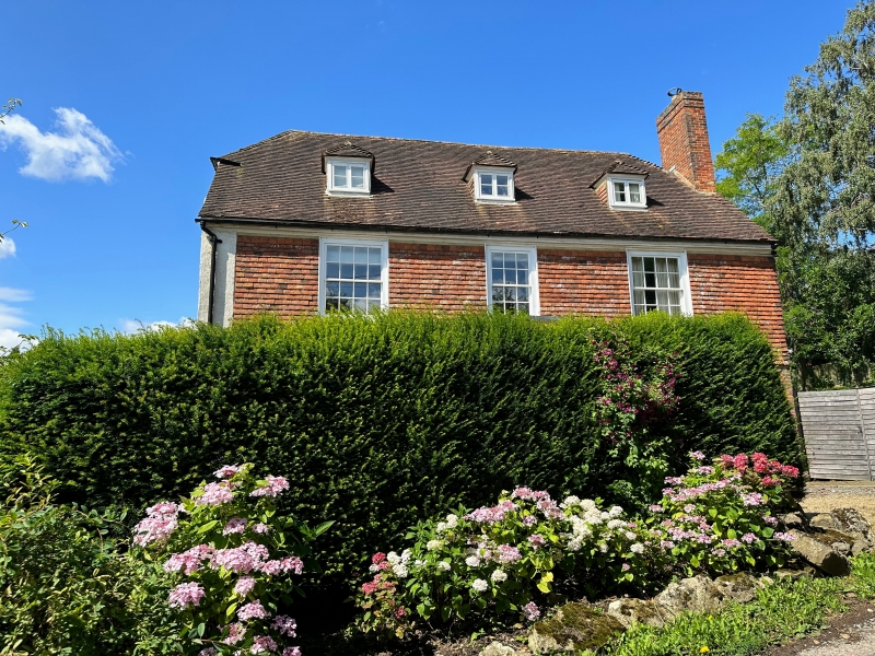
WESTERHILL ROAD TW 75 SW LINTON (West Side) 2/165 Westerhill Farmhouse 23.5.67 II Farmhouse. C18, with later C18 or early C19 alterations and additions. Ground floor chequered red and grey brick, first floor with exposed framing of thin scantling. Plain tile roof. 2 storeys, attic and cellar on stone plinth. Moulded wooden eaves cornice. Half-hipped roof. Rear stack to left of centre and slightly projecting brick stack to right gable end. 3 hipped, corniced dormers. Regular 3-window front of two 16-pane sashes and central 12-pane sash. Central half-glazed door with rectangular fanlight in panelled recess, up one step. Doorway flanked by Doric pilasters, formerly part of a porch. Later 2-storey rear addition to left, with half-hipped roof. Interior not inspected.
Listing NGR: TQ7421749950
External links are from the relevant listing authority and, where applicable, Wikidata. Wikidata IDs may be related buildings as well as this specific building. If you want to add or update a link, you will need to do so by editing the Wikidata entry.


Other nearby listed buildings