Latitude: 54.1315 / 54°7'53"N
Longitude: -2.5828 / 2°34'57"W
OS Eastings: 362017
OS Northings: 470782
OS Grid: SD620707
Mapcode National: GBR BNDN.MQ
Mapcode Global: WH952.9FC2
Plus Code: 9C6V4CJ8+HV
Entry Name: Cattle Pens at Moss House
Listing Date: 24 September 1990
Grade: II
Source: Historic England
Source ID: 1263122
English Heritage Legacy ID: 182534
ID on this website: 101263122
Location: Wennington, Lancaster, Lancashire, LA2
County: Lancashire
District: Lancaster
Civil Parish: Wennington
Traditional County: Lancashire
Lieutenancy Area (Ceremonial County): Lancashire
Church of England Parish: Tunstall St John the Baptist and Melling St Wilfred and Leck St Peter
Church of England Diocese: Blackburn
Tagged with: Pen
WENNINGTON SPOUT LANE SD 67 SW 5/192 Cattle Pens at Moss House. II GV The serial No shall be amended to read:- 5/193 In the last line of the description the (ref 5/191) shall be amended to read (5/194)
------------------------------------
WENNINGTON SPOUT LANE SD 67 SW 5/192 Cattle pens at Moss House.
GV II
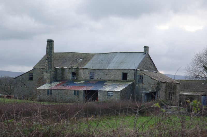
Integrated cattle pens and stable forming part of a model farm. Built 1845 by W.A.F. Saunders of Wennington Hall. Local coursed watershot freestone; blue Ulverston slate. 3 single-storeyed ranges forming on U-plan around former manure depot (now replaced); heifers were accommodated in the W range, milkers and calves to the north, yearlings and horses to the E. High set openings to outer elevations are largely intact. Windows and doorways to 'inner elevations have undergone only minor alterations. Some stalls to the stable survive but are very decayed. This building forms the livestock area and was associated (and groups) with the mechanised range to the north (ref 5/191).
Listing NGR: SD6201770782
External links are from the relevant listing authority and, where applicable, Wikidata. Wikidata IDs may be related buildings as well as this specific building. If you want to add or update a link, you will need to do so by editing the Wikidata entry.


Other nearby listed buildings