Latitude: 52.3969 / 52°23'48"N
Longitude: 0.2704 / 0°16'13"E
OS Eastings: 554571
OS Northings: 280074
OS Grid: TL545800
Mapcode National: GBR M6H.P66
Mapcode Global: VHHJD.M0SW
Plus Code: 9F4297WC+P5
Entry Name: 35-39, Waterside
Listing Date: 19 June 1972
Grade: II
Source: Historic England
Source ID: 1262317
English Heritage Legacy ID: 435352
ID on this website: 101262317
Location: Ely, East Cambridgeshire, CB7
County: Cambridgeshire
District: East Cambridgeshire
Civil Parish: Ely
Built-Up Area: Ely
Traditional County: Cambridgeshire
Lieutenancy Area (Ceremonial County): Cambridgeshire
Church of England Parish: Ely
Church of England Diocese: Ely
Tagged with: Building
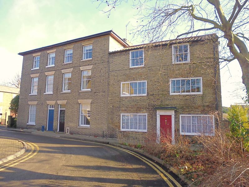
WATERSIDE 1. 1082 (East Side) Nos 35 to 39 (odd) TL 5479 2/2l8 II GV 2 An early C19 building comprising a main block (has 35 and 37) and an additiin on the south end (No 39). Both blocks are 3 storey but the addition is lower and has the second storey windows blocked. The main block is 4 window range, double-hung sashes with glazing bars, in plain reveals with stone lintels. Paired central doorways have rectangular fanlights and plain reveals. The addition is 2 window range, small 5-light windows, double-hung sashes with glazing bars, in flush cased frames. No 39 has a 6-Panel door with a wood doorcase with pilasters and cornice. Roofs slate, the main block is hipped.
No 33 and Smithy at the rear, Nos 35 to 41 (consec), Nos 43 to 47 (odd), Nos 51 to 53 (consec), Melthouse adjoining No 53, No 55 and the house adjoining No 55 and Quayside House form a group with Nos 54 to 64 (even)
Listing NGR: TL5457180074
External links are from the relevant listing authority and, where applicable, Wikidata. Wikidata IDs may be related buildings as well as this specific building. If you want to add or update a link, you will need to do so by editing the Wikidata entry.


Other nearby listed buildings