Latitude: 51.3092 / 51°18'33"N
Longitude: 0.8727 / 0°52'21"E
OS Eastings: 600316
OS Northings: 160600
OS Grid: TR003606
Mapcode National: GBR RTR.ZBS
Mapcode Global: VHKJW.2CQ5
Plus Code: 9F328V5F+M3
Entry Name: Laurel Cottage
Listing Date: 27 September 1989
Grade: II
Source: Historic England
Source ID: 1260978
English Heritage Legacy ID: 438949
ID on this website: 101260978
Location: Ospringe, Swale, Kent, ME13
County: Kent
District: Swale
Civil Parish: Faversham
Built-Up Area: Faversham
Traditional County: Kent
Lieutenancy Area (Ceremonial County): Kent
Tagged with: Cottage
FAVERSHAM MUTTON LANE TR 0060 (south side) Ospringe F 96 11/188 (local list) Laurel Cottage Interior Inspected II
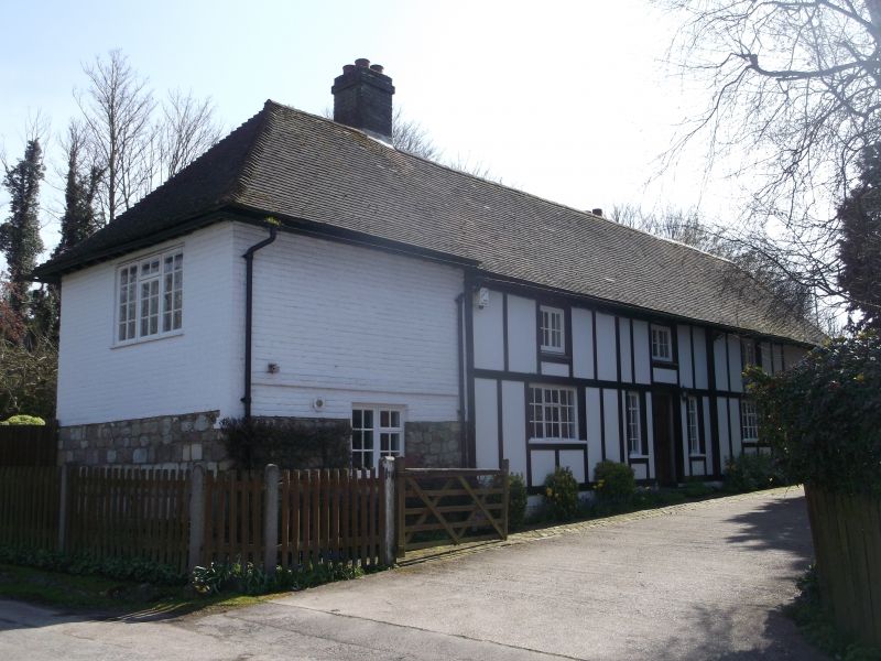
House. C16 or earlier, altered and extended early C18 and mid C20. Timber framed and clad with render and applied framing, and extended with hammer dressed stone and painted brick. Plain tiled roof. Three bay framed house in origin, possibly a small Wealden type. Two storeys on plinth with plat band to left end bay (which projects slightly to both front and rear elevations) and with recessed central bay. Hipped roof, stepped up to left, and with rebuilt stacks to left and to end right. Four 2 light wooden casements on first floor and five wooden casements on ground floor of 2, 3, 1 and 3 lights, all mid C20. Central door of 6 panels and garage doors to end left. The ground floor stonework of the end left bay, until recently galleted, may come from the nearby and partly demolished Maison Dieu building, at Ospringe Street, certainly the exposed brick dressing on the plinth, the plat bands on both front and rear elevations suggest a C17 or C18 date for the building of this bay. Interior: full frame visible, of rather slight scantling, but with arched tension bracing to main beams, some alteration of wall plate, probably c,1700. Roof not accessable. Early photographs show arched braced frame exposed to main exterior elevations.
Listing NGR: TR0031660600
External links are from the relevant listing authority and, where applicable, Wikidata. Wikidata IDs may be related buildings as well as this specific building. If you want to add or update a link, you will need to do so by editing the Wikidata entry.


Other nearby listed buildings