Latitude: 53.1656 / 53°9'56"N
Longitude: -1.4785 / 1°28'42"W
OS Eastings: 434958
OS Northings: 363287
OS Grid: SK349632
Mapcode National: GBR 69Y.K0W
Mapcode Global: WHDFN.8P5K
Plus Code: 9C5W5G8C+6H
Entry Name: Lime Tree House
Listing Date: 31 January 1967
Grade: II
Source: Historic England
Source ID: 1260176
English Heritage Legacy ID: 393477
ID on this website: 101260176
Location: Ashover, North East Derbyshire, S45
County: Derbyshire
District: North East Derbyshire
Civil Parish: Ashover
Built-Up Area: Ashover
Traditional County: Derbyshire
Lieutenancy Area (Ceremonial County): Derbyshire
Church of England Parish: Ashover All Saints
Church of England Diocese: Derby
Tagged with: House
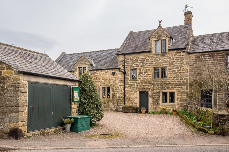
ASHOVER MOOR ROAD 1264-0/11/68 (East side) 31/01/67 Lime Tree House GV II House. Dated 1705, with C20 alterations. Coursed squared rubble gritstone with quoins, coped gables, a gable stack at the west end, and a Welsh slate roof. South elevation of 2 storeys and attic and 2 bays, with an off-centre doorway, and an altered window to the east, both openings beneath plain lintels. 2 first floor openings, one a 2-light C17 chamfered mullioned window with 6-paned casement and fixed light, the other a single-light C17 opening with a leaded light. C19 gabled dormer to attic, with a 2-light window having 6-pane casements. Plaque above inscribed: 'G I H 1705'.
Listing NGR: SK3495863286
External links are from the relevant listing authority and, where applicable, Wikidata. Wikidata IDs may be related buildings as well as this specific building. If you want to add or update a link, you will need to do so by editing the Wikidata entry.


Other nearby listed buildings