Latitude: 52.1228 / 52°7'22"N
Longitude: -2.0333 / 2°2'0"W
OS Eastings: 397813
OS Northings: 247164
OS Grid: SO978471
Mapcode National: GBR 2JH.W71
Mapcode Global: VHB0K.PXX1
Plus Code: 9C4V4XF8+4M
Entry Name: Newhaven
Listing Date: 3 August 1972
Grade: II
Source: Historic England
Source ID: 1259903
English Heritage Legacy ID: 443554
ID on this website: 101259903
Location: Lower Moor, Wychavon, Worcestershire, WR10
County: Worcestershire
District: Wychavon
Civil Parish: Hill and Moor
Built-Up Area: Lower Moor
Traditional County: Worcestershire
Lieutenancy Area (Ceremonial County): Worcestershire
Church of England Parish: Fladbury, Hill and Moor, Wyre Piddle, Cropthorne and Charlton
Church of England Diocese: Worcester
Tagged with: Building Thatched cottage
HILL AND MOOR LOWER MOOR 1. 2301 Bridge Street Newhaven SO 94 NE 10/495 II GV
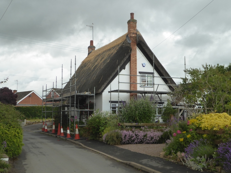
2. C17. Timber frame and whitened brick nogging partly cement rendered. Thatched roof. Casements. Modern door with tiled hood.
Cottage occupied by Haines, Old Timbers, Newhaven, Nos l and 2 (0akleigh] and Cottage occupied by Mrs Lampitt form a group.
Listing NGR: SO9781347164
External links are from the relevant listing authority and, where applicable, Wikidata. Wikidata IDs may be related buildings as well as this specific building. If you want to add or update a link, you will need to do so by editing the Wikidata entry.


Other nearby listed buildings